How Map-Based Project Management Tools Can Be Utilized in an Academic Setting
In the realm of environmental sciences, hands-on fieldwork is essential for students to gain practical experience and apply theoretical knowledge. However, effective data collection, organization, and analysis can often be challenging. Enter map-based project management tools—innovative platforms that can revolutionize how students conduct fieldwork and manage their notes. This blog explores the benefits of these tools for environmental sciences students and how they can enhance the educational experience.
The Importance of Fieldwork in Environmental Sciences
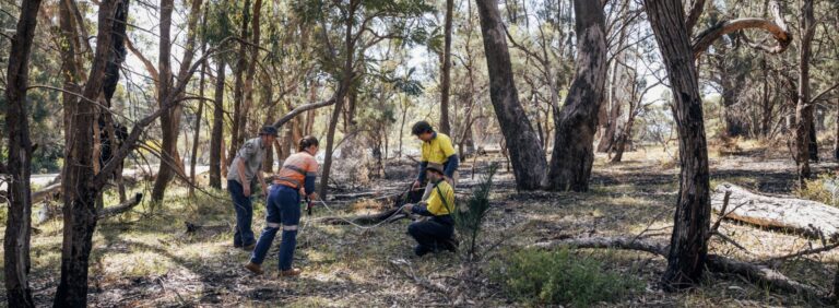
Fieldwork is a cornerstone of environmental sciences education. It allows students to observe ecosystems, collect samples, and analyze real-world environmental issues. However, the success of fieldwork relies heavily on effective planning, data collection, and organization of findings. This is where map-based project management tools come into play, offering a dynamic way to streamline these processes.
Fieldwork is more than just a means of gathering data; it’s an opportunity for students to connect with the environment and see their classroom knowledge come to life. By directly interacting with ecosystems, students develop critical thinking and problem-solving skills that prepare them for careers in the environmental sector. However, traditional methods of conducting fieldwork—using paper maps, handwritten notes, and manual data entry—can be inefficient and prone to error. Modern tools offer a much-needed upgrade to these outdated approaches. In recent years, systematic mapping has been shown to play an important role in evidence syntheses by cataloging evidence on specific subjects, which is beneficial in environmental sciences [1].
Benefits of Map-Based Tools for Fieldwork
Spatial Visualization of Data
One of the key advantages of map-based project management tools is their ability to visualize data spatially. Students can visualize projects on a map, marking specific locations and attaching data such as species observations, water quality measurements, or soil samples directly to geographical points. This spatial context not only enhances understanding but also aids in identifying patterns and trends in environmental data.
For instance, students studying biodiversity in a forest can mark areas with high species density and analyze how environmental factors like soil quality or water availability influence these hotspots. Such insights are invaluable for drawing meaningful conclusions and developing actionable conservation strategies.
Real-Time Collaboration
Fieldwork often involves teams of students working together to gather data and manage projects. Map-based project management tools facilitate real-time collaboration, allowing team members to update information instantly. For example, if one student makes a significant observation or updates important project details, others can view it immediately. This enhances communication, minimizes data duplication, and ensures that all team members are on the same page and working off the most recent data [2].
Collaboration extends beyond the field. Students can work together on analyzing data and preparing reports, even if they’re in different locations. This flexibility is especially useful for remote learning or for projects that span large geographical areas.
Organized Data Collection

Traditional note-taking methods can lead to disorganized data, making it challenging to analyze findings later. With map-based tools, students can create structured data forms that guide their note-taking. They can categorize information by type (e.g., flora, fauna, water quality) and attach notes, photos, or other relevant files directly to map points. This organized approach simplifies data management and facilitates easier analysis post-fieldwork.
Moreover, organized data collection ensures that no critical information is overlooked. Students can set up prompts or reminders within the tool to ensure they record all necessary parameters, improving the quality and completeness of their datasets.
Enhanced Reporting and Presentations
When it comes time to report on fieldwork findings, map-based project management tools allow students to create visually appealing presentations. They can generate maps that showcase their findings, complete with annotations and supporting data. This not only makes presentations more engaging but also aids in conveying complex information clearly to their peers or instructors.
For example, a student group studying urban pollution could present a map highlighting areas with high pollution levels, overlaid with data on population density and industrial activity. Such visualizations make it easier for audiences to grasp the interplay between different factors and understand the scope of the issue.
Practical Applications in the Classroom
Instructors can integrate map-based project management tools into their curriculum by assigning field projects that require students to utilize these platforms. For example, a project could involve assessing local biodiversity in a specific area, where students must record species locations, habitat conditions, and potential environmental threats.
By using a map-based tool, students can visually represent their findings, fostering a deeper understanding of ecological relationships and environmental challenges. Additionally, instructors can track student progress in real-time, providing guidance and support throughout the fieldwork process. Moreover, students can gain hands-on experience in managing projects, covering everything from budget management to role assignments, just as they would in real-world scenarios.
These tools also offer opportunities for interdisciplinary learning. For instance, students from environmental sciences could collaborate with those studying geography, computer science, or public policy to address complex environmental challenges. Such projects encourage students to think holistically and understand the interconnected nature of modern environmental issues.
Preparing Students for the Workforce
Map-based project management tools not only enhance the academic experience but also prepare students for careers in environmental sciences and related fields. Many industries—from conservation to environmental site assessments as well as disaster management—rely on similar tools to plan and execute projects. By gaining proficiency in these tools during their studies, students develop a valuable skill set that gives them a competitive edge in the job market.
Moreover, these tools foster a mindset of efficiency and innovation. Students learn to approach problems systematically, leverage technology to optimize workflows, and communicate findings effectively—all of which are essential skills for future professionals.
Conclusion
Map-based project management tools present a powerful opportunity for environmental sciences students to enhance their fieldwork and note-taking experiences. By enabling spatial visualization, real-time collaboration, organized data collection, and effective reporting, these tools can significantly improve the educational journey. As technology continues to advance, incorporating these innovative solutions into environmental sciences education will empower students to become more skilled and informed environmental stewards. By gaining proficiency in tools like this, students will enhance their competitive edge, making it easier for them to enter the industry after graduation.