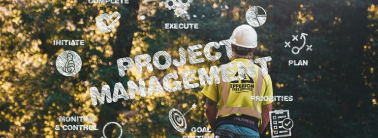
From Data to Decision: Best Practices for Collaborative Environmental Project Management
Introduction
Environmental services projects—ranging from soil and groundwater remediation to air‐quality monitoring and ecosystem restoration—are among the most technically demanding and heavily regulated endeavors undertaken by engineering and consulting firms. Success depends on weaving together scientific rigor, regulatory compliance, stakeholder collaboration, and the right software platforms to manage vast volumes of field and laboratory data. Whether you’re tackling legacy pollution at contaminated sites or pioneering green‐infrastructure solutions, adhering to project management best practices ensures safety, efficiency, and community trust. Below, we delve into a comprehensive set of strategies and tools to elevate your next environmental services engagement.
1. Defining Scope, Objectives, and Success Criteria
Comprehensive Project Charter
- Document the purpose, goals, and constraints of the remediation or monitoring effort.
- Reference industry frameworks such as the Project Management Institute’s PMBOK® Guide for standardized terminology and processes.
Site Assessment and Phase I/II Investigations
- Perform Phase I Environmental Site Assessments (ESA) per ASTM E1527-21, followed by targeted Phase II sampling to quantify contaminant concentrations.
- Use geospatial mapping and historic aerial imagery to frame the investigation.
SMART Objectives
- Ensure Specific, Measurable, Achievable, Relevant, and Time‐bound targets for contaminant reduction, monitoring frequency, and stakeholder deliverables.
- Establish Key Performance Indicators (KPIs) such as treatment efficiency (% reduction of target analytes), Safety Incident Rate (SIR), and Permit Compliance Rate.
2. Building a Multidisciplinary Team
Technical Expertise
- Engage environmental engineers, hydrogeologists, and toxicologists early. Each discipline contributes to accurate risk modeling and remedial design.
Regulatory and Legal Advisors
- Integrate in‐house counsel or specialized consultants to navigate complex federal, state, and local permits—drawing on resources like the Environmental Law Institute.
Community and Stakeholder Liaisons
- Appoint a dedicated Public Involvement Specialist to manage outreach, public comment periods, and community advisory boards.
External Partners
- Leverage partnerships with academic institutions or technology vendors (e.g., geophysical survey firms) to augment in‐house capabilities.
A clear RACI (Responsible, Accountable, Consulted, Informed) matrix aligned to each deliverable prevents role confusion and streamlines decision‐making.
3. Advanced Collaboration Techniques
Digital Collaboration Hubs
- Deploy integrated platforms such as Procore or Autodesk BIM 360 that combine document control, drawing markups, and field data capture.
Agile and Iterative Planning
- Break large remediation tasks into 2–4-week “sprints” with defined deliverables (e.g., installing a temporary monitoring well network).
- Conduct sprint reviews and retrospectives to adapt priorities based on monitoring data or regulatory feedback.
Real‐Time Data Sharing
- Use mobile field apps to upload sampling results and QA/QC checks directly to central software systems, enabling remote experts to validate data within hours.
These techniques accelerate feedback loops, enhance transparency, and foster a culture of continuous improvement.
4. Managing Remediation at Contaminated Sites
Risk‐Based Prioritization
- Follow the U.S. EPA’s Risk Assessment Guidance to rank areas by potential exposure pathways and toxicity.
Adaptive Remediation Design
- Combine in situ methods (e.g., bioremediation, chemical oxidation) with ex situ treatments (e.g., soil washing, thermal desorption) based on performance benchmarks.
- Establish decision gates tied to site monitoring data, allowing for escalation or de‐scoping of treatment as conditions warrant.
Health, Safety, and Environment (HSE) Management
- Develop a site‐specific Health and Safety Plan (HASP) aligned with OSHA’s Hazardous Waste Operations and Emergency Response Standard.
- Perform daily site briefs, toolbox talks, and incident investigations to ensure zero lost‐time accidents.
By embedding risk assessments and safety protocols into every phase, teams protect both workers and surrounding communities.
5. Leveraging Software for Data Integration and Decision Support
Environmental projects generate massive volumes of heterogeneous data—from field sampling results and laboratory analyses to GIS layers and equipment logs. Modern software platforms streamline this complexity by providing centralized, collaborative environments where teams can visualize, analyze, and act on real-time information. Here’s how to maximize these tools:
Centralized Data Hub and Spatial Collaboration
- Matidor (matidor.com) offers a cloud-based map-first interface where project teams can upload sampling points, lab reports, and monitoring site data directly onto an interactive map. This geospatial context turns static spreadsheets into dynamic storyboards—enabling rapid identification of contaminant migration patterns across contaminated sites.
- Customizable layers let you overlay historical imagery, land-use zoning, and permit boundaries, while role-based access ensures regulators, clients, and field teams see only the data pertinent to their responsibilities, fostering secure collaboration across disciplines.
Real-Time Field-to-Office Workflows
- Mobile apps built into Matidor empower field technicians to capture GPS-tagged observations, photographs, and QA/QC checklists, which sync instantly to the central project portal.
Integrated Reporting and Analytics Dashboards
- Rather than manually exporting data to third-party BI tools, Matidor’s dashboard builder allows you to plot contaminant concentration trends, treatment performance metrics (e.g., percent reduction of TPH or heavy metals), and budget burn rates—all within the same platform.
- Drill-down filters enable stakeholders to interrogate data by date, analyte, or sample location, supporting data-driven meetings and compliant submittals without toggling between multiple software systems.
Automated Task Tracking and Resource Management
- Matidor’s task module ties action items—like field activities and task completion—to map features and project milestones. Dependencies can be visualized in Gantt-style timelines, ensuring resources are allocated where and when needed.
- Integration with email platforms (e.g., Gmail, Outlook) automates reminder workflows, reducing administrative overhead and the risk of missing critical permit deadlines.
Scalable Templates and Reusable Workflows
- Once you’ve configured a “project template” in Matidor—complete with geospatial layers, QA/QC forms, and reporting dashboards—you can clone it for similar contaminated sites, slashing startup time on future bids.
- Version control and audit logs maintain a complete history of edits, maximizing transparency for internal audits and external regulatory reviews.
By weaving Matidor into your technology stack—alongside EDMS solutions like EarthSoft EQuIS and project-controls tools such as Oracle Primavera P6—you create a cohesive ecosystem. This not only reduces manual data handoffs and transcription errors but also transforms static numbers into actionable intelligence, empowering teams to remediate contaminated sites more efficiently, safely, and collaboratively.
Automating data pipelines reduces transcription errors, accelerates report generation, and empowers decision makers with actionable insights.
6. Ensuring Regulatory Compliance and Quality Assurance
Regulatory Tracking and Notification
- Maintain a living compliance calendar tied to permit expiry dates, sampling deadlines, and public notice periods. Tools like RegScan can automate alerts when regulations change.
Quality Assurance/Quality Control (QA/QC)
- Implement documented procedures for field and lab QA/QC, including equipment calibrations, duplicate samples, and matrix spikes.
- Conduct third‐party audits of data workflows annually to verify adherence to ISO 9001 quality management principles.
Dynamic Risk Registers
- Track potential project risks—unexpected soil strata, extreme weather, supply‐chain delays—and assign mitigation actions, owners, and contingency budgets.
Proactive compliance management and rigorous QA/QC guard against costly rework and regulatory penalties.
7. Harnessing Emerging Technologies
Unmanned Aerial Vehicles (UAVs) and LiDAR
- Deploy drones for high‐resolution aerial mapping of site topography, vegetation stress (via multispectral imaging), and thermal anomalies indicative of subsurface contamination.
Internet of Things (IoT) Sensors
- Install wireless groundwater and air‐monitoring sensors that stream real‐time data to cloud platforms, triggering alerts if contaminant levels breach action thresholds.
Digital Twins and 3D Modeling
- Create dynamic 3D digital replicas of the site using GIS, BIM, and sensor data to simulate remediation progress, optimize equipment placement, and plan future land use.
By integrating these innovations, environmental teams can reduce site visits, improve data quality, and make preemptive decisions backed by robust analytics.
8. Stakeholder and Community Engagement
Transparent Communication Strategies
- Launch dedicated project websites or portals (e.g., WordPress, ArcGIS Hub) that publish weekly updates, interactive maps, and FAQ sections.
Public Workshops and Virtual Town Halls
Digital Dashboards for Performance Metrics
- Offer stakeholders read‐only access to dashboards showcasing KPIs such as groundwater quality trends, project spending vs. budget, and HSE performance.
Active engagement not only builds social license but also uncovers on‐the‐ground insights that can refine project execution.
9. Measuring Success: KPIs and Performance Metrics
| KPI | Description | Target |
| Schedule Performance Index (SPI) | Ratio of Earned Value to Planned Value | ≥ 0.95 |
| Cost Performance Index (CPI) | Ratio of Earned Value to Actual Cost | ≥ 1.00 |
| Treatment Effectiveness | Percentage reduction in contaminant concentrations | ≥ 90% for primary contaminants |
| Safety Incident Rate (SIR) | Number of recordable incidents per 200,000 work‐hours | 0 |
| Community Satisfaction Score | Stakeholder survey score on transparency and responsiveness | ≥ 4 out of 5 |
Regularly reviewing these indicators in executive dashboards ensures projects remain on track financially, technically, and socially.
10. Training, Competency, and Continuous Improvement
Competency Development
- Certify project staff through programs like the Association for the Advancement of Cost Engineering (AACE) and OSHA HAZWOPER training.
Lessons Learned Workshops
- Hold formal debriefs at project milestones and close‐out, capturing successes (e.g., effective use of remote sensors) and areas for improvement (e.g., permit turnaround times).
Process Standardization
- Update corporate procedure manuals and software templates based on workshop outputs, embedding improved workflows into future bids and proposals.
A structured approach to knowledge management drives organizational excellence and reduces learning curves on subsequent projects.
11. Case Study: Brownfield Redevelopment in Urban Center
A mid‐sized consulting firm led a 24-month remediation of a former industrial site in a dense metropolitan area:
Challenge: Soil and groundwater contaminated with polycyclic aromatic hydrocarbons (PAHs) and heavy metals.
Approach:
- Multidisciplinary Team: Environmental engineers, geophysicists, legal counsel, and community liaisons.
- Collaboration Platform: Adopted Autodesk BIM 360 for document control and drone‐based LiDAR for site mapping.
- Adaptive Remediation: Phased in situ chemical oxidation followed by monitored natural attenuation—decision gates tied to quarterly performance reviews.
- Stakeholder Engagement: Hosted monthly virtual “town halls” with 200+ attendees, publishing real‐time water‐quality dashboards.
Outcomes:
- Achieved 95 percent reduction in target PAH concentrations within 18 months.
- Completed remediation under budget by 7 percent through optimized scheduling and resource reallocation.
- Received a community commendation award for transparency and minimal disruption.
This project underscores how strategic collaboration, cutting‐edge software, and adaptive management at contaminated sites deliver sustainable results.
Conclusion
Delivering environmental services projects—particularly remediation of contaminated sites—requires more than technical prowess. It demands an orchestrated approach that blends structured project management, cross‐disciplinary collaboration, proactive stakeholder engagement, and powerful software solutions. By defining clear scopes, harnessing emerging technologies, embedding compliance and QA/QC, and continuously measuring KPIs, project teams can mitigate risks, optimize costs, and foster community trust. As environmental regulations evolve and public scrutiny intensifies, those organizations that master these best practices will lead the industry in both impact and innovation.