.jpg)

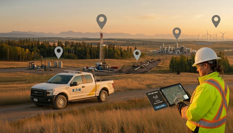
GIS tools are no longer just for mapping – they’re essential for project collaboration. Industries like oil & gas, renewables, and environmental services rely on GIS to manage data, make decisions, and boost efficiency. Here’s a quick breakdown of the top GIS features that can transform how teams work together:
- Real-Time Multi-User Editing: Collaborate on maps instantly without delays.
- Version Control: Track changes, maintain accuracy, and work without interruptions.
- Cross-Platform Sync: Seamlessly share data across devices (desktop, mobile, and web).
- Offline Data Collection: Keep working in remote areas without internet.
- User Permissions: Control who can access, edit, or share data securely.
- Location-Based Comments: Add notes directly to map points for clear communication.
- Automatic Data Validation: Catch errors instantly to ensure data reliability.
- Built-In Communication Tools: Discuss updates without leaving the GIS platform.
- Change History Tracking: See who made edits and when for better accountability.
- Custom Report Templates: Standardize reporting for consistent project updates.
Why it matters:
- Teams can save time, reduce errors, and make better decisions.
- Tools like Matidor, ArcGIS, and QGIS offer these features, but their capabilities differ. For example, Matidor excels in ease of use and offline functionality, while ArcGIS offers advanced tools for experienced users.
Quick Comparison:

GIS is key for managing complex, large-scale projects. Whether you’re working in remote areas or need real-time updates, these features ensure smooth collaboration and accurate data. Ready to dive into the details? Let’s explore each feature and how it can help your team.
Distributed Collaboration: Editing Across Environments
1. Real-Time Multi-User Editing
Real-time multi-user editing allows multiple team members to work on maps and layers at the same time. This removes the usual delays caused by waiting for others to finish their edits before accessing important project data.
Collaboration Efficiency
When users can edit simultaneously, everyone works with the most up-to-date information[2]. This eliminates the need for constant back-and-forth communication. Instead of relying on emails or phone calls to coordinate changes, team members can see updates as they happen and respond right away. For instance, a Gartner survey revealed a 44% rise in the use of collaboration tools by workers since 2019, with nearly 80% adopting such tools by 2021[2]. Real-world examples include urban planning teams updating infrastructure maps in real time, environmental monitoring groups sharing field data instantly to take quick action, and telecommunications companies improving network planning through shared GIS editing.
Data Integrity and Versioning
Maintaining accurate data during simultaneous edits requires strong conflict-resolution systems. Real-time collaboration not only speeds up updates but also improves accuracy by enabling crowd-sourced validation. Modern GIS platforms incorporate features like context-specific templates and branch versioning to ensure spatial relationships are correct and conflicts are resolved effectively. These tools also pave the way for advanced collaboration options, such as detailed permission settings.
User Permissions and Security
Granular permission controls give administrators the power to manage access, monitor edits, and protect sensitive data. Features like editor tracking record who makes changes, while hosted feature layer views can limit edits to specific geographic areas, features, or attributes.
2. Version Control for Spatial Data
Version control takes real-time multi-user editing a step further by providing a structured way to track changes, preserve a full history of edits, and streamline collaboration. For spatial data, this means greater precision and smoother teamwork.
Data Integrity and Versioning
In GIS, versioning allows multiple versions of spatial data to coexist within a centralized or distributed database. This setup ensures that each user sees an independent view of the data, enabling ongoing edits without interruptions, even across multiple sessions [7]. As projects evolve, version control keeps a detailed record of every change, ensuring data integrity throughout the process [6].
Versioning is the mechanism that enables concurrent multiuser geodatabase editing in ArcSDE geodatabases. It uses an optimistic concurrency data-locking model, which means no locks are applied to affected features and rows during long transactions.[8]
There are two main approaches to versioning spatial data:
- State-based versioning: This method stores an entire copy of each version, making it easier to understand but requiring more storage space.
- Delta-based versioning: This approach saves only the changes made between versions, reducing storage needs but requiring more effort to reconstruct the full dataset [7].
The choice between these methods depends on factors like storage availability and technical complexity.
Collaboration Efficiency
Version control removes many of the roadblocks that traditionally slowed down collaborative efforts. With this system, multiple users can edit the same geodatabase at the same time, without locking features or duplicating data [4]. For example, an environmental team can update water quality data while engineers refine infrastructure plans – all within the same project – without waiting for one another to finish.
Another advantage is the ability to publish and share specific data versions without altering the original dataset [7]. For instance, a project manager can create a version to share progress updates with stakeholders while the core team continues working on the main dataset. This separation ensures that external feedback doesn’t interfere with ongoing work.
User Permissions and Security
Version control systems also handle permissions, ensuring that only authorized users can access, edit, or publish specific versions of the data. These granular controls are crucial for managing sensitive or proprietary information [8].
Additionally, features like historical archiving and geodatabase replication provide an audit trail that tracks every change back to its source. This not only helps with accountability but also allows teams to revert to previous versions if mistakes occur, safeguarding against accidental data loss or unauthorized changes [7].
For organizations using platforms like Matidor, version control integrates seamlessly with real-time project tracking and GIS visualization tools. This integration creates a unified workspace where spatial data versioning works hand-in-hand with budgeting, team collaboration, and reporting features, making project management more efficient and organized.
3. Cross-Platform Data Sync
Cross-platform data synchronization ensures spatial data remains consistent across various devices and platforms. This feature reshapes how field teams collaborate by bridging the gaps between desktop GIS systems, mobile devices, and web-based platforms.
Collaboration Efficiency
Cross-platform sync revolutionizes teamwork by enabling smooth data sharing across different work environments. Field crews can collect data on tablets while office staff analyze it on desktop workstations – all without the hassle of manual transfers or version conflicts.
Multi-user GIS collaboration improves efficiency by allowing team members to work on the same datasets simultaneously, reducing the need for repetitive data transfer and minimizing version control issues. Real-time updates and shared access streamline workflows and facilitate faster decision-making. [3]
The impact on workflows is game-changing. Teams no longer have to deal with delays caused by exporting files, sending emails, or manually uploading data. Updates made in the field are instantly visible in the office, enabling real-time decision-making and speeding up project timelines. For instance, a surveyor using a tablet can update asset locations, and an engineer working on a desktop can immediately incorporate those changes into their analysis. This level of seamless collaboration reinforces data accuracy and enhances productivity across platforms.
Data Integrity and Versioning
Ensuring data accuracy across multiple platforms requires advanced conflict resolution and validation processes. Modern systems tackle simultaneous edits with tools like timestamps and field-specific rules designed to handle cross-device challenges.
Organizations that implement automated reconciliation processes have seen measurable improvements in data quality. For example, in 2024, companies using these systems reported a 40% drop in human errors, while those with strong version control mechanisms experienced a 30% reduction in customer support issues tied to data inconsistencies [10]. Establishing clear conflict resolution strategies is critical. When conflicts arise, systems can prioritize data based on factors such as source reliability, timestamps, or predefined business rules. Considering that over 70% of businesses face issues with data conflicts, robust synchronization processes are essential to avoid potential financial setbacks [10].
Accessibility (Online/Offline)
Cross-platform sync goes beyond real-time updates by accommodating varying connectivity conditions. Field teams can collect data offline, with automatic syncing occurring once they reconnect.
Real-world examples highlight the importance of this capability. A team installing rural broadband infrastructure in remote areas can sync surveys, photos, and videos effortlessly once they regain connectivity [11]. Similarly, utility workers maintaining infrastructure in isolated locations can use preloaded feature service layers to access detailed property information, allowing them to navigate and complete tasks efficiently without an active internet connection [11].
Platforms like Matidor take this a step further by integrating cross-platform sync with real-time project tracking and GIS visualization tools. This creates a unified workspace where field data collection, budget management, and team collaboration harmonize, whether teams are online or working offline in remote locations. These synchronization features align seamlessly with other GIS tools, enhancing overall project management and collaboration through Matidor’s platform.
4. Offline Map Editing and Data Collection
Offline map editing and data collection are game-changers for field teams working in areas with unreliable or no internet access. By enabling productivity in remote locations, these features ensure that important work continues without interruptions.
Collaboration Efficiency
Offline editing removes the challenges posed by poor connectivity, making field operations smoother and timelines more predictable. Teams can access and update GIS data without depending on a network connection. To avoid duplicated records and confusion, assign specific geographic zones to individuals or teams, which helps clarify responsibilities and streamline workflows.
Take Bermuda’s National Park system as an example. In September 2023, they revamped their editing workflows to address connectivity issues. By registering feature classes as branch versioned and enabling replica tracking, mobile workers were able to edit data offline and sync their changes later without hassle[14]. This kind of offline functionality, however, requires strict versioning protocols to ensure data accuracy and consistency.
Data Integrity and Versioning
Ensuring data quality during offline operations calls for careful planning and reliable synchronization processes. Registering feature classes as branch versioned and enabling replica tracking is key to effectively monitoring changes[14]. Depending on organizational needs, teams can either sync updates directly with the default version for immediate integration or use separate versions for review before merging[13]. Regular synchronization and conflict resolution workflows are essential when multiple editors are working on the same dataset[13].
Accessibility (Online/Offline)
Combining online and offline capabilities gives field teams the flexibility to adapt to varying conditions. For example, planning offline maps in advance is crucial – downloading a 1 GB tile package over a strong connection takes about 30 minutes[12].
The City of Hastings, Nebraska, provides a great example of this flexibility. By adopting ArcGIS Utility Network, the city moved from paper maps to digital tools, significantly improving efficiency, accuracy, and communication through real-time data collection[16].
Similarly, Matidor’s integrated offline mode and real-time synchronization simplify project management in remote areas. This tool allows field teams to continue collecting data and managing projects offline, with automatic synchronization as soon as connectivity is restored. The combination of offline capabilities and real-time tracking ensures seamless workflows, even in the most remote locations.
5. User Permission Controls
User permission controls are essential for maintaining secure and efficient GIS collaboration. They enable project managers to define who can access, edit, or export specific datasets, ensuring that sensitive project data remains protected.
Collaboration Efficiency
Well-implemented permission controls simplify teamwork by clearly defining roles and responsibilities within GIS teams. Modern GIS platforms allow for detailed access settings – such as view, edit, export, collect, and update – reducing confusion and preventing unauthorized changes.
Role-based access control (RBAC) is a common approach, assigning permissions based on job functions. This not only streamlines onboarding but also safeguards sensitive areas of a project.
Take ArcGIS Enterprise as an example. It uses shared update groups to manage access and editing permissions in portal projects. This setup allows specific team members to update shared items while ensuring that sensitive data remains secure. ArcGIS Enterprise supports four distinct access levels: organization administrator, portal project owner, write access user, and view-only access user[18]. These clearly defined roles enhance collaboration while reinforcing security protocols.
User Permissions and Security
Weak access controls are often cited by security experts as a major cause of data breaches and theft[21]. Past incidents highlight the importance of strict permission settings to mitigate these risks[20].
The principle of least privilege is a cornerstone of secure GIS collaboration. By granting users only the permissions they need for their tasks, organizations significantly reduce the risk of unauthorized access[22]. When combined with multi-factor authentication, this principle adds an extra layer of protection. As Justin Mallinckrodt, Product Manager for ArcGIS Enterprise at Esri, puts it:
Authentication plays a crucial role in this by ensuring that only authorized users can access sensitive information.[19]
Data Integrity and Versioning
Strong permission controls also play a vital role in maintaining data integrity throughout a project’s lifecycle. By preventing unauthorized modifications and keeping detailed audit trails, organizations can ensure data quality. Administrators can use schemas and domains to organize data and assign permissions with precision, allowing, for example, field technicians to update asset conditions without altering critical infrastructure boundaries or financial data[9].
Audit trails are invaluable for tracking database activity, identifying issues quickly, and ensuring regulatory compliance. Additional safeguards like regular backups, encryption, and continuous monitoring further protect sensitive information[9].
Platforms like Matidor incorporate these security measures seamlessly. Its role-based access controls protect sensitive project data while enabling effective collaboration. Features like audit trails and user activity monitoring allow project managers to maintain data integrity across field operations. Only authorized personnel can modify critical project details, and every change is logged for accountability.
This comprehensive permission framework works hand-in-hand with real-time editing and version control, ensuring that GIS projects remain both secure and accurate.
6. Location-Based Comments and Notes
Location-based comments and notes bring a whole new level of clarity to team communication in GIS projects by tying discussions directly to specific points on a map. This eliminates the confusion that often comes with describing geographic areas through emails or separate messaging tools. When combined with real-time editing and version control, this approach ensures that feedback is not only immediate but also laser-focused on the right location. It’s a practical way to boost collaboration alongside other GIS editing features.
Collaboration Efficiency
By enabling real-time communication within the GIS platform itself, location-based comments reduce the need for external tools [1]. Feedback can be linked to specific layers or map elements, keeping discussions relevant and actionable. For example, urban planning teams can quickly annotate proposed changes to infrastructure. Plus, mobile-friendly interfaces let project managers and field teams stay connected, no matter where they are, allowing them to review and update project data on the go [24]. These notes also serve as a valuable archive of insights, helping teams preserve institutional knowledge and tackle common challenges [23].
Accessibility (Online/Offline)
Offline functionality is a game-changer for fieldwork and remote projects. Many GIS platforms let users download maps for offline use, ensuring that comments and notes can still be created and reviewed even in areas without internet access [26].
User Permissions and Security
Managing who can access, create, or modify location-based comments is crucial for maintaining data security. Role-based permissions – such as Viewer or Publisher – allow for tailored access, while custom roles offer even finer control. This becomes especially important in collaborative projects where protecting sensitive data and preventing unauthorized changes are top priorities [70,71].
Matidor takes these features a step further by offering seamless location-based commenting tools paired with robust role-based access controls. Field teams can leave site-specific notes and receive updates from managers, even while offline. Once back online, all changes sync automatically. This setup makes Matidor a reliable choice for secure and efficient collaboration on field service projects.
7. Automatic Data Validation
Automatic data validation plays a crucial role in maintaining data quality by catching issues like incorrect phase assignments, missing connectivity links, and invalid device connections as they happen [27]. This real-time process ensures that everyone works with accurate and reliable data from the very beginning.
Collaboration Efficiency
By automating data validation, teams can skip time-consuming manual checks and focus on more valuable tasks [5].
The benefits are clear in practice. David Woolley, a GIS Analyst at the City of Fountain, has seen firsthand how automation improves workflows. He conducts monthly validation checks that now take just 15 minutes, thanks to automated tools. As he puts it:
Data cleanup is important because we’re trying to keep the lights on. We’ve got crews out there at two in the morning, and if we’re providing them with inaccurate information, the work takes longer, plus it’s more expensive and difficult. [27]
This kind of real-time validation boosts collaboration between field teams and office staff, ensuring everyone works from the same reliable data. It also creates a foundation for effective version control and data authenticity.
Data Integrity and Versioning
Automatic validation acts as a safeguard for project data, ensuring it meets quality standards by identifying errors, inconsistencies, and gaps. This not only prevents costly mistakes but also builds confidence in the data being used for decision-making [28]. Tools like topology checks, domain validation, and attribute consistency tests [5] help quickly detect and address issues, while advanced error management pinpoints the exact source of problems [30].
Terri Bunting from Tucson Water Department highlights the value of this approach:
We have so much more confidence in our data. We feel good about having a conversation with someone because we know exactly where our data stands and what we need to do to fix it. [29]
Accessibility (Online/Offline)
Automatic validation adapts seamlessly to varying connectivity conditions. While offline, validation rules are temporarily bypassed, allowing field teams to continue gathering data without interruptions. Once the data is synced with the central system, validation rules are applied [15].
Many mobile GIS tools ensure data quality by running these validations upon reconnection, making it possible for teams to work efficiently in remote areas.
Platforms like Matidor integrate this dual-layer validation into their workflows, ensuring data integrity both online and offline. Field teams receive immediate feedback on data quality while working, and automatic validation kicks in during synchronization with the central system. This approach ensures high data standards without disrupting field operations, allowing teams to maintain quality regardless of connectivity challenges.
8. Built-In Communication Tools
Built-in communication tools bring project discussions and updates into the same workspace as spatial data. By keeping everything in one place, team members can collaborate without juggling multiple apps. This setup makes it easier to update project details and manage access efficiently.
Collaboration Efficiency
These tools allow teams to exchange ideas, provide feedback, and coordinate fieldwork – all without stepping outside their main workspace. According to a Gartner survey, the use of collaboration tools jumped by 44% since 2019, with nearly 80% of workers using them in 2021. This surge highlights how real-time updates can keep everyone aligned, helping teams make better decisions [2].
Accessibility (Online/Offline)
Adaptability to connectivity changes ensures smooth data sharing between the field and the office. For instance, in 2022, Ameren, a utility company serving over 2.4 million customers in the Midwest, adopted EpochField Mobile. This GIS-enabled, mobile mapping solution – built using the ArcGIS Runtime SDK for .NET – allowed field crews to work both online and offline. Crews could download updated GIS data as needed and continue capturing updates offline, syncing them once reconnected [33].
User Permissions and Security
Security features ensure that only authorized users can access specific channels and share data, striking a balance between collaboration and safeguarding sensitive information [32]. Role-Based Access Control (RBAC) simplifies this process, granting field technicians the access they need while restricting sensitive areas.
Ed Barrett, Broadband Business Unit President at HR Green, notes:
GIS revolutionizes broadband network design by offering superior data organization and analysis capabilities – truly invaluable for the requirements established for BEAD compliance [31].
Platforms like Matidor incorporate these communication tools directly into GIS workflows. This integration allows field teams to share updates, request support, and coordinate activities securely, ensuring data integrity and proper access controls. By combining secure communication with GIS functionality – like data editing – these platforms keep everything working seamlessly together.
9. Change History Tracking
Change history tracking keeps a detailed record of every modification made to spatial data throughout a project’s lifecycle. It automatically logs who made the changes, when they happened, and what specific edits were performed. This level of detail provides teams with a clear view of how their data evolves over time, making it easier to understand project progress and hold team members accountable. Beyond just documenting edits, this feature also enhances team coordination by offering a transparent overview of all changes.
Collaboration Efficiency
In large, complex GIS projects, having a complete record of geoprocessing tasks and data edits can be a game-changer. A chronological log not only highlights what has been completed but also reveals frequently used processes. This kind of audit trail fosters accountability and helps teams systematically track the project’s evolution.
With access to detailed task histories, teams can easily revisit and rerun past tasks, even tweaking parameters to adapt them for new operations [35]. Real-time updates and shared access to these histories further simplify workflows, enabling faster and more informed decision-making [3]. Managers can quickly review completed tasks, spot inefficiencies, and redistribute work to keep the project moving efficiently.
Data Integrity and Versioning
Change history tracking also plays a critical role in maintaining the integrity of spatial data. By logging every dataset modification, it ensures that changes are fully documented. For example, editor tracking adds fields such as created_user, created_date, last_edited_user, and last_edited_date, so every edit is attributed to a specific user and timestamped [34]. This system helps prevent data loss and ensures that reliable information is always available for decision-making [36]. A practical illustration of this is when one user adds a school to the dataset, and another later updates its enrollment details – both actions are recorded [34].
Accessibility (Online/Offline)
Change history tracking isn’t limited to online environments. It works offline by associating edits with the offline user and syncing the complete audit trail once the user reconnects [15]. Field teams can download data, make edits on-site, and then sync their changes back to the main system, ensuring that every modification is captured [15].
Platforms like Matidor excel in this area, offering seamless change history tracking whether teams are connected or working remotely. Field teams can update data in isolated locations, and once connectivity is restored, all their changes are documented and synced – ensuring nothing is overlooked or lost.
10. Custom Report Templates
Custom report templates simplify project communication by ensuring everyone works with consistent formats. This standardization keeps reporting clear and organized throughout the project.
Collaboration Efficiency
Using standardized templates helps teams work more efficiently by streamlining how data is collected and shared. When everyone follows the same format, less time is wasted figuring out how to present information, allowing teams to focus on the actual work at hand. These templates can even be embedded into specific tasks, making reporting a natural part of the workflow [37].
Reports organize, communicate, and record any information identified as being relevant to the mission” [37]
Megha Kakaraparti, Product Engineer, Esri
By creating uniformity, templates make it easier to review and act on information. Field crews can quickly generate reports using pre-designed formats, while project managers benefit from receiving consistent data. This is especially helpful when multiple teams handle different project phases or when new members join mid-project.
With real-time data synchronization, reports always reflect the most current information, helping teams identify and address issues early. This consistency not only improves efficiency but also bolsters data accuracy by linking reports to specific versions of the dataset.
Data Integrity and Versioning
Templates automatically track the version of the data used, ensuring a clear audit trail. When reports are generated from versioned GIS data, the system records which dataset version was referenced. This eliminates data conflicts, even when multiple editors are working simultaneously, as each report ties back to a specific version [6].
Teams can maintain a flat version tree structure, where the default version serves as the foundation for all reporting templates. This setup prevents accidental data corruption and ensures reports are consistently accurate [6]. Additionally, these templates can adapt to varying connectivity conditions without compromising functionality.
Accessibility (Online/Offline)
Templates can be downloaded with map data, allowing teams to complete reports offline and sync updates once they’re back online. This feature is crucial for projects in remote areas with limited internet access or when teams need to work independently for extended periods.
Platforms like Matidor shine in maintaining template usability across different environments. Teams can capture data, generate reports, and store everything locally until they reconnect with the central database. These templates automatically integrate geographical data and media files, ensuring reports include location-specific context, even when created offline.
Whether online or offline, templates remain fully functional across devices. Team members can use tablets in the field or desktop computers in the office, all while working with identical report structures and data formats [17].
Feature Comparison Table
To better understand how different platforms support project collaboration, the table below compares key features across several GIS platforms.

This table highlights how each platform approaches collaboration, showcasing their strengths and limitations. Matidor stands out for its combination of advanced features and ease of use, making it particularly appealing for teams seeking a straightforward yet robust solution. ArcGIS Pro, on the other hand, offers powerful technical tools and extensive editing capabilities, catering to users with advanced needs [38]. Meanwhile, QGIS operates on a simpler model, where users take turns making edits unless using multi-user-friendly formats like PostGIS [40].
One noteworthy example comes from March 2025, when an environmental services company praised Matidor for its adaptability. The platform worked closely with the company to import their existing projects and implemented ongoing improvements tailored to their needs, earning high marks as a project management tool [41].
Key features like permission controls and offline functionality vary widely among platforms, reflecting different levels of user management and remote work support. This comparison serves as a helpful starting point for teams evaluating GIS platforms. Ultimately, the best choice will depend on a team’s specific workflows, expertise, and budget, balancing feature needs with project demands.
Conclusion
GIS features play a pivotal role in transforming team collaboration by turning scattered data into actionable insights. Tools like real-time editing, offline functionality, and built-in communication features help teams stay aligned, even when spread across different locations and time zones. This seamless integration improves data accuracy and supports better decision-making across various industries.
By connecting spatial data with detailed project information, GIS provides a solid framework for analysis that enhances communication, efficiency, and overall project management. Consider this: only 16% of fully implemented IT projects are completed on time and within budget [44]. This statistic highlights just how critical it is to select the right tools for effective collaboration.
Industries like oil and gas, as well as renewables, benefit significantly from GIS solutions tailored to their needs. For example, GIS enables oil and gas operators to optimize drilling locations by analyzing geological data, environmental factors, and logistical considerations [43]. A great example of this tailored approach is Matidor, a platform designed specifically for sectors like environmental services, oil and gas, and renewable energy. It combines advanced GIS visualization with field service management tools, offering features like real-time project tracking, budget oversight, and collaboration capabilities. This allows teams to harness GIS technology without the steep learning curve of more generalized systems.
When choosing GIS tools for your organization, focus on identifying your specific needs, testing demos with your actual workflows, and ensuring the solution integrates smoothly with your existing systems. The goal isn’t to find the tool with the most features but to implement one that genuinely supports your team’s way of working.
Looking ahead, collaboration platforms will increasingly merge spatial intelligence with streamlined project management. With the right GIS features, you can turn geographic complexities into opportunities for effortless teamwork.
FAQs
How does real-time editing in GIS tools improve team collaboration?
Real-time editing in GIS tools makes it possible for multiple team members to collaborate on geospatial data at the same time. This ensures that everyone is working with the latest information, cutting out delays caused by outdated data and improving communication. The result? Faster decisions and fewer mistakes.
With instant updates and immediate feedback, real-time collaboration creates a more connected and efficient workflow. Teams can bring together a variety of perspectives, boosting both accuracy and productivity. This feature is especially crucial in fields like environmental services and urban planning, where having up-to-the-minute data can make or break a project.
How does cross-platform data synchronization benefit field teams working in remote locations?
Cross-platform data synchronization allows field teams to access and update project details, even in remote areas where internet connectivity is limited or unavailable. When the connection is restored, any offline updates are automatically synced with the central database.
This feature keeps teams productive, minimizes delays, and ensures everyone is working with accurate, up-to-date information – no matter where their job takes them.
How do user permission controls in GIS platforms enhance data security and accuracy?
User permission controls are essential for safeguarding sensitive data and maintaining its integrity within GIS platforms. By assigning role-based access, organizations can determine who has the ability to view, edit, or manage critical project details. This approach minimizes the chances of unauthorized access or accidental modifications that could jeopardize the data’s accuracy.
To further enhance security, features like multi-factor authentication provide an additional layer of defense against potential breaches. These tools ensure that only authorized individuals can access specific information, helping to maintain both the security and reliability of data in field service projects.
.webp)
.webp)
.webp)
.webp)
%20(2).webp)
.webp)
.webp)


.webp)

.webp)

.jpg)


%20(1).webp)


.jpg)

.jpg)
.jpg)


.jpg)