Unified Visibility for Complex, Multi-Site Operations
Whether construction, utilities, property management, or mining, gain real-time control over distributed operations with one platform.
Overview
When you manage operations across dozens of sites with distributed teams, spreadsheets break down fast. Budget visibility lags behind reality. Field teams use disconnected systems. Project status requires manual consolidation. Geographic coordination happens through guesswork. Matidor unifies project management, budget tracking, location intelligence, and field operations into one platform. Real-time visibility replaces week-end summaries. Geographic coordination eliminates resource waste. Standardized workflows replace scattered processes.
Trusted by Multi-Site Operations Teams Across Industries


.png)


.png)


What Disconnected Systems, Budget Delays, and Geographic Blindness Actually Cost You
Industry 1
Spreadsheet Chaos Doesn't Scale Past 10 Projects
Managing 5 projects in spreadsheets works. Managing 50 is impossible.
Project status lives in multiple spreadsheets owned by different managers. Budget tracking happens in accounting systems with 5 to 7 day delays. Field updates arrive through email, text messages, and phone calls. Monthly reporting takes your best people three days of manual consolidation.
When executives ask for portfolio health, you can't answer without scheduling a meeting. When clients ask about project status, you need to contact three people. When budget questions arise, you wait for accounting to compile reports.
Industry 2
Field Teams Work Disconnected from Office Reality
Remote crews collect data on paper or consumer apps not built for field operations. Photos lack GPS coordinates and timestamps. Inspections happen without standardized checklists. Equipment tracking relies on phone calls.
Data flows into the office days or weeks after collection. Manual transcription creates errors. Field teams can't see budget status or updated priorities. Office teams wait for Friday updates to understand what happened Monday through Thursday.
Industry 3
Geographic Distribution Is Invisible
When you manage 40 properties, 25 construction sites, or 100 utility assets across regions, spreadsheets hide the geographic reality. You can't see which sites are near each other. Resource allocation happens without spatial context.
Asset locations tracked separately from operations. Regulatory zones in different systems. Infrastructure context unavailable. Planning happens without complete geographic awareness.
Portfolio Visibility, Field Connectivity, and Geographic Intelligence
Unlike spreadsheets and accounting systems with 5-7 day delays, Matidor shows budget and project status in real-time. Unlike office-only tools, Matidor works 100% offline for remote field teams. Unlike scattered systems, Matidor centralizes everything in one platform with complete geographic visualization.
Portfolio Dashboards Replace Spreadsheet Chaos
All projects display on unified dashboards with color-coded health indicators. See which need attention at a glance without waiting for status meetings. Custom workflows enforce your processes across all sites. Centralized communication replaces email threads. Monthly reporting generates in minutes instead of days.
Offline Mobile Apps Connect Field Teams
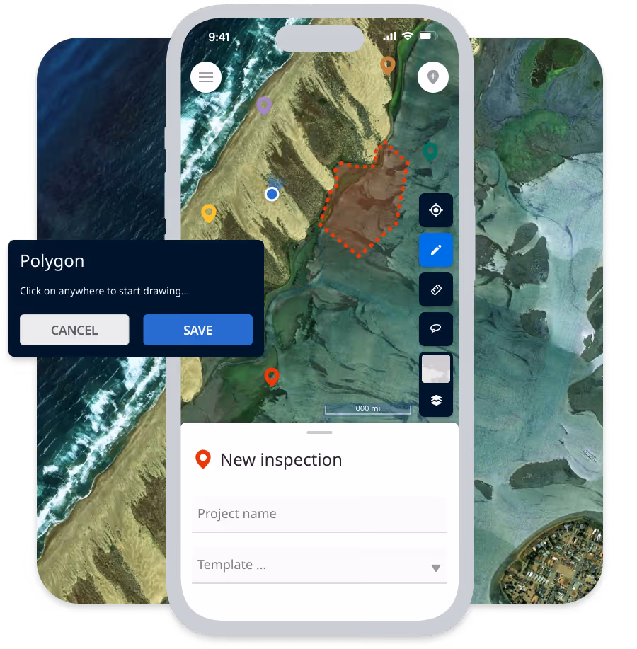
Mobile apps work 100% offline at remote sites. Field crews collect data, capture GPS-tagged photos, complete inspection forms, and track equipment without connectivity. Everything syncs automatically when connection returns. Office teams see field updates in real-time as data flows in.
.avif)
Real-Time Budget Tracking Prevents Overruns
Track spending as field teams log time and expenses through mobile apps. Budget alerts trigger automatically at 70%, 90%, and 100% thresholds, giving you time to adjust before overruns lock in. Sync with accounting systems eliminates duplicate entry and reconciliation delays.
Visualize Assets and Operations Geographically
All sites, facilities, and assets plot automatically on interactive maps with exact GPS coordinates. Layer multiple data types: asset locations with status, service areas, jurisdictional boundaries, infrastructure networks, and operational zones. See complete geographic context for better resource allocation and coordination decisions.
Beyond Oil & Gas and Environmental Services
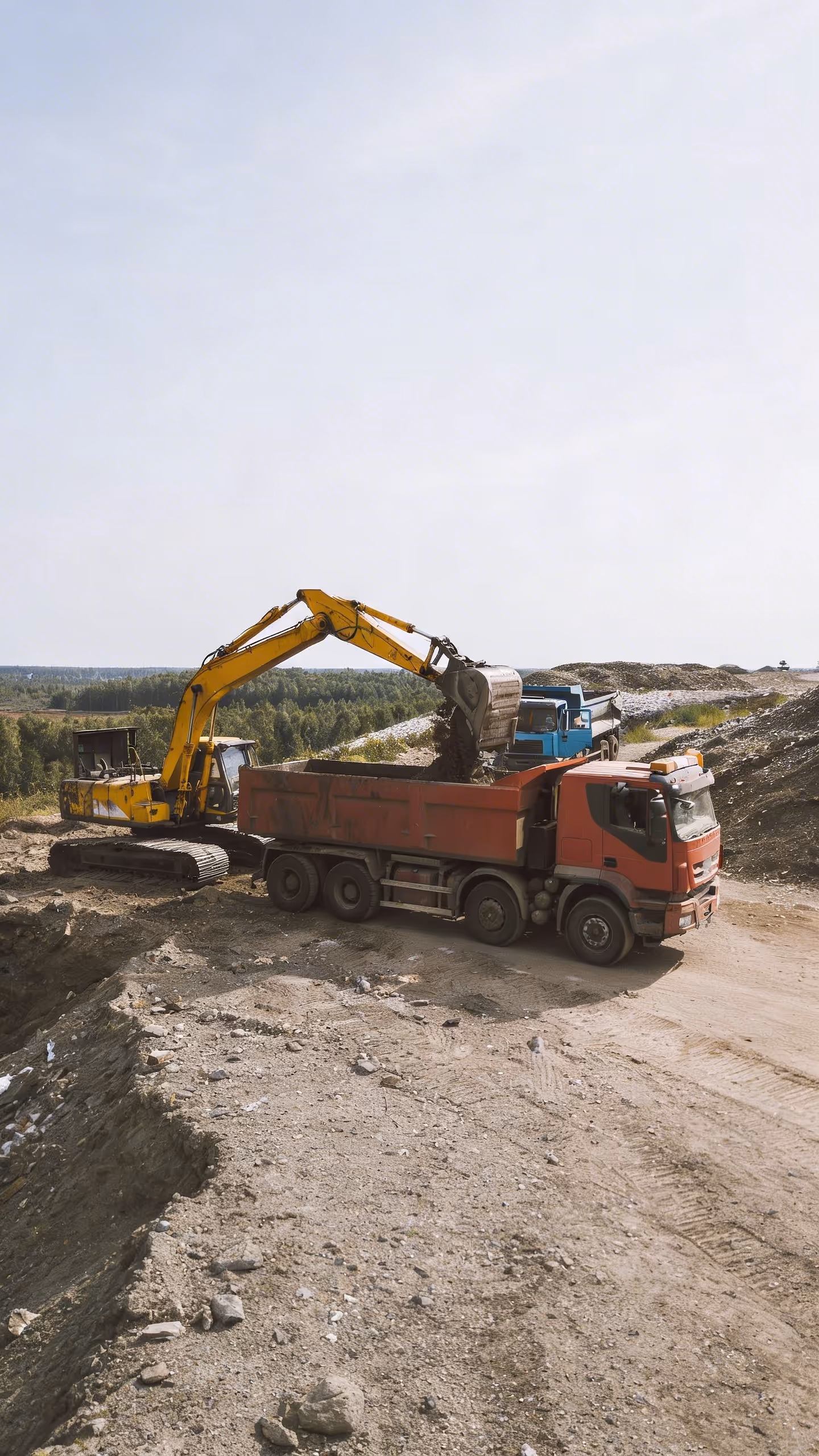
Construction & Infrastructure
Construction & Infrastructure
General contractors and specialty trades managing 20+ concurrent projects across regions gain real-time visibility into project health, budget status, and resource allocation. Mobile data collection works at remote job sites. Geographic coordination reduces mobilization costs.
Common Use Cases:
- Multi-site commercial construction
- Infrastructure project portfolios
- Subcontractor coordination
- Equipment tracking across sites
Utilities and Telecom
Utilities and Telecom
Electric, water, gas, and telecom companies managing distributed infrastructure gain unified visibility across maintenance, repairs, and capital projects. Offline mobile works in remote service areas. Asset mapping shows infrastructure with service territories and regulatory zones.
Common Use Cases:
- Maintenance work order management
- Infrastructure inspection programs
- Capital project tracking
- Asset condition monitoring
Property Management
Property Management
Commercial property managers overseeing 30+ buildings across multiple markets track maintenance, capital improvements, and vendor coordination in one platform. Budget tracking by property and portfolio. Geographic visualization shows property locations with market boundaries.
Common Use Cases:
- Multi-property maintenance coordination
- Capital improvement project tracking
- Vendor performance management
- Budget control by property
Mining & Extraction
Mining & Extraction
Mining operations managing exploration, development, and production across multiple sites gain real-time operational visibility. Offline mobile works at remote mine sites. Geographic visualization shows operations with claim boundaries and regulatory zones.
Common Use Cases:
- Exploration program management
- Mine development tracking
- Production site coordination
- Regulatory compliance documentation
Municipal & Government
Municipal & Government
Cities, counties, and regional governments managing public works, parks, facilities, and infrastructure projects gain unified operational visibility. Geographic visualization shows assets with jurisdictional boundaries and service districts.
Common Use Cases:
- Public works project tracking
- Facility maintenance management
- Parks and recreation coordination
- Capital improvement programs
Renewable Energy
Renewable Energy
Solar, wind, and battery storage developers managing project pipelines from development through construction gain portfolio visibility. Geographic visualization shows project sites with land parcels, interconnection zones, and regulatory jurisdictions.
Common Use Cases:
- Development pipeline tracking
- Construction project management
- Site acquisition coordination
- Interconnection milestone tracking
Vegetation Management
Vegetation Management
Managing right-of-way survey, ROW inspection, or utility vegetation programs? See our dedicated Vegetation Management solution.
Industry Professionals Using Matidor


Detailed Success Stories Across Industries
Pease Park Case Study

Surge Energy Case Study

Rife Case Study

Project Forest Case Study
Multi-Site Operations Using Matidor
Construction: 30 Concurrent Commercial Projects
General contractor manages 30 commercial projects across three states with 15 project managers and 200 field personnel. Budget control critical. Geographic coordination reduces mobilization costs.
Before Matidor: Each project manager maintains their own spreadsheets. Budget tracking happens monthly through accounting. Field updates arrive via text and email. Portfolio status requires three days of manual consolidation. Site locations tracked in separate mapping tool.
With Matidor: All 30 projects visible on unified dashboard with color-coded health. Field crews submit daily reports through mobile. Real-time budget tracking shows spending per project. Geographic map shows all sites with proximity filtering and regulatory zones overlaid. Portfolio reporting generates in minutes.
Result: Portfolio visibility improves dramatically. Budget overruns caught early. Project managers coordinate resources geographically. Monthly close time reduces substantially.

Utilities: 500 Kilometers of Distribution Infrastructure
Electric utility manages maintenance and capital projects across 500 kilometers of distribution lines in rural service territory. Field crews work in areas with limited connectivity. Asset condition tracking critical for regulatory compliance.
Before Matidor: Work orders tracked in legacy system. Field crews use paper forms. Asset condition data manually entered after crews return. Budget tracking quarterly through invoicing. Infrastructure mapped in separate GIS system.
With Matidor: Work orders and inspections completed on mobile apps that work 100% offline. Asset condition data syncs automatically with GPS coordinates and timestamps. Real-time budget tracking per project. All infrastructure displays on maps with service territories, regulatory jurisdictions, and environmental constraints overlaid.
Result: Field data collection becomes reliable in remote areas. Asset condition documentation audit-ready. Budget stays controlled across all projects. Complete infrastructure visibility with service and regulatory context.
Frequently Asked Questions About Multi-Site Operations Software
Commercial construction, infrastructure projects, specialty trade work, multi-site residential development, and any construction operations managing 10+ concurrent projects across multiple locations. Matidor handles project tracking, subcontractor coordination, equipment management, budget control, and field documentation.
Track work orders for maintenance and repairs, manage capital improvement projects, conduct infrastructure inspections with offline mobile, monitor asset condition with GPS-tagged documentation, visualize service territories with infrastructure networks on maps, and coordinate crews based on geographic proximity.
Yes. Create projects for each property or building, manage maintenance work orders and capital improvements, track vendor performance and costs by property, monitor budget by building and portfolio, coordinate maintenance teams across properties, and visualize all properties on maps with market boundaries.
Exploration programs, mine development projects, production site management, environmental monitoring and reclamation, regulatory compliance tracking, and multi-site coordination across exploration, development, and production operations. Offline mobile works at remote mine sites without connectivity.
Track capital improvement projects, manage facility maintenance and repairs, coordinate parks and recreation operations, monitor budgets by department and project, document compliance with municipal regulations, and visualize all assets and projects on maps with jurisdictional boundaries and service districts.
Yes. Track development pipeline from site acquisition through interconnection, manage construction projects with contractor coordination, monitor budgets for development and construction phases, visualize project sites with land parcels and regulatory zones, track permitting and compliance milestones, and coordinate multi-site operations geographically.
Highly customizable through configuration, not custom development. Create industry-specific project templates, design custom mobile forms for your data collection needs, configure budget structures matching your cost accounting, build approval workflows reflecting your processes, and customize reports for your stakeholders. Implementation includes workflow design and configuration.
Matidor serves any organization managing complex multi-site field operations regardless of industry. If you manage 10+ projects across multiple locations with distributed teams, budget control requirements, and geographic coordination needs, Matidor likely provides value. Schedule a discovery call to discuss your specific situation and determine fit.
See Matidor in Action With Your Projects
Schedule a Discovery Call
Talk with our team about your specific industry challenges and operational pain points.
We'll Discuss:
- Your current operational challenges and workflow bottlenecks
- How organizations in similar industries use Matidor
- Customization requirements for your specific workflows
- Realistic implementation timeline and resource requirements
- Transparent pricing for your organization size
- Honest assessment of whether Matidor fits your needs
No sales pressure. We'll tell you if we're not a good fit.
Or Start Free for 14 Days
Get full platform access immediately. Import your current projects. Test mobile apps with your field crews. See real results with your own data.
- Full access to all platform features
- Live chat support during trial
- No credit card required
- Cancel anytime