How Bowron Environmental Group Replaced Inconsistent Field Data With a Standardized, Real Time Project System
Company: Bowron Environmental Group Ltd.
Industry: Environmental Consulting, Contamination Assessment, Site Closure and Liability Management
Contact: Laura Jardin, Intermediate Environmental Scientist
Location: Calgary, Alberta, Canada
See how Matidor works for environmental consulting and site closure teams.


The Company
Bowron Environmental Group Ltd. is a Canadian owned environmental consulting firm headquartered in Calgary, Alberta. The company provides environmental compliance, contamination assessment, site closure, and liability management services for energy, mining, and civil infrastructure clients across the Western Canadian Sedimentary Basin.
Overseeing day to day project operations is Laura Jardin, Intermediate Environmental Scientist. Her team is responsible for managing multi site field programs, standardizing data collection across project types, coordinating field personnel, tracking costs against active budgets, and delivering accurate, timely reports to clients.

The Challenge
Before Matidor, Bowron managed active sites, budgets, and reporting using a combination of spreadsheets and email. Neither tool gave the team a consistent, structured view of work in progress or field data quality. Tracking what had been collected, where costs stood, and whether submissions met scope requirements required constant manual follow up, and the lack of a centralized system created compounding problems across programs.
The day to day impact was significant:
- Field data submitted in inconsistent formats, including hand drawn sketches, handwritten borehole logs, and raw GPS files, with no shared structure across programs.
- No live geospatial view of site locations, boundaries, or sample points, which meant spatial errors were only discovered during post processing
- Budget information lagged behind actual spend, making it difficult to catch cost issues before they accumulated.
- Communication between office and field relied on emails and verbal updates rather than a shared system, leaving gaps in accountability and data completeness.
For a team managing multiple environmental programs simultaneously, the inability to see site data spatially, standardize submissions, and track costs in real time meant work was being planned and executed with limited visibility into what was actually happening in the field.
Why Matidor
Matidor's GIS native design matched how Laura's team needed to think about the work: geographically. The ability to define lease boundaries, log sample points on a live map, validate incoming field data against expected locations, and manage budgets and workflows within the same platform addressed the core gaps left by spreadsheets and email.
Laura JardinIntermediate Environmental Scientist, Bowron Environmental Group
Matidor's features mapped directly to Bowron's needs:
Real time field visibility
Standardized spatial data
Budget and cost tracking
Field ready forms and workflows
Reporting and dashboards
The Solution in Action
Standardized Project Workflows by Scope Type
Bowron uses Matidor as the operational backbone across active field programs, with every project tracked in the platform. Work progress, field notes, costs, and budgets are centralized by project type and scope, giving the team one queryable view of all work in progress.
Laura's team has built a linked workflow where forms move sequentially through each project phase. A planning form captures the initial workplan, a field scope of work form with required fields records execution, and office and reporting scopes follow to close out documentation.
This structure has improved scope ownership, reduced email volume, and made it easier to answer client questions quickly because all relevant data lives in one place.

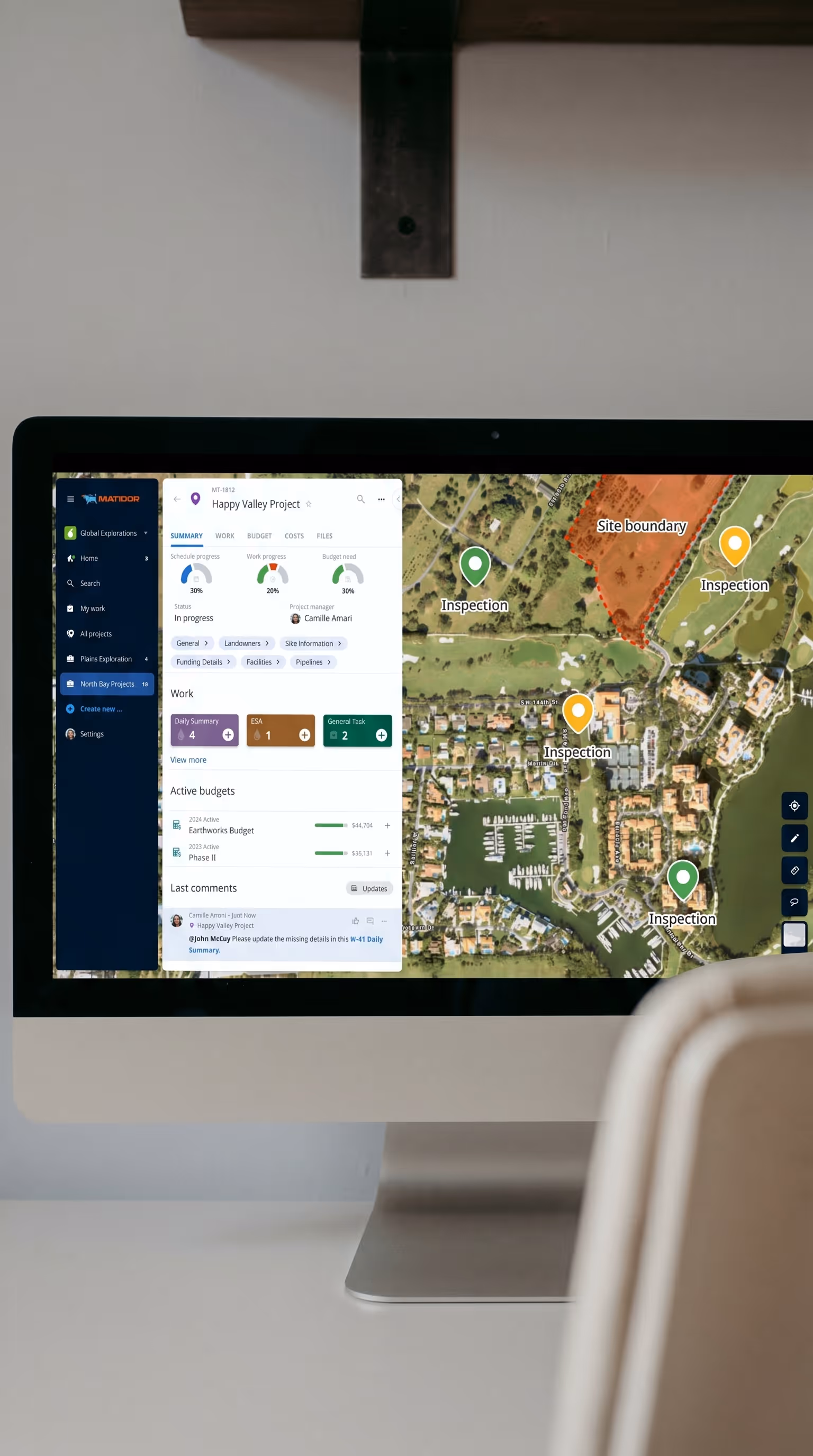
Map-Based Planning and Real Time Spatial Validation
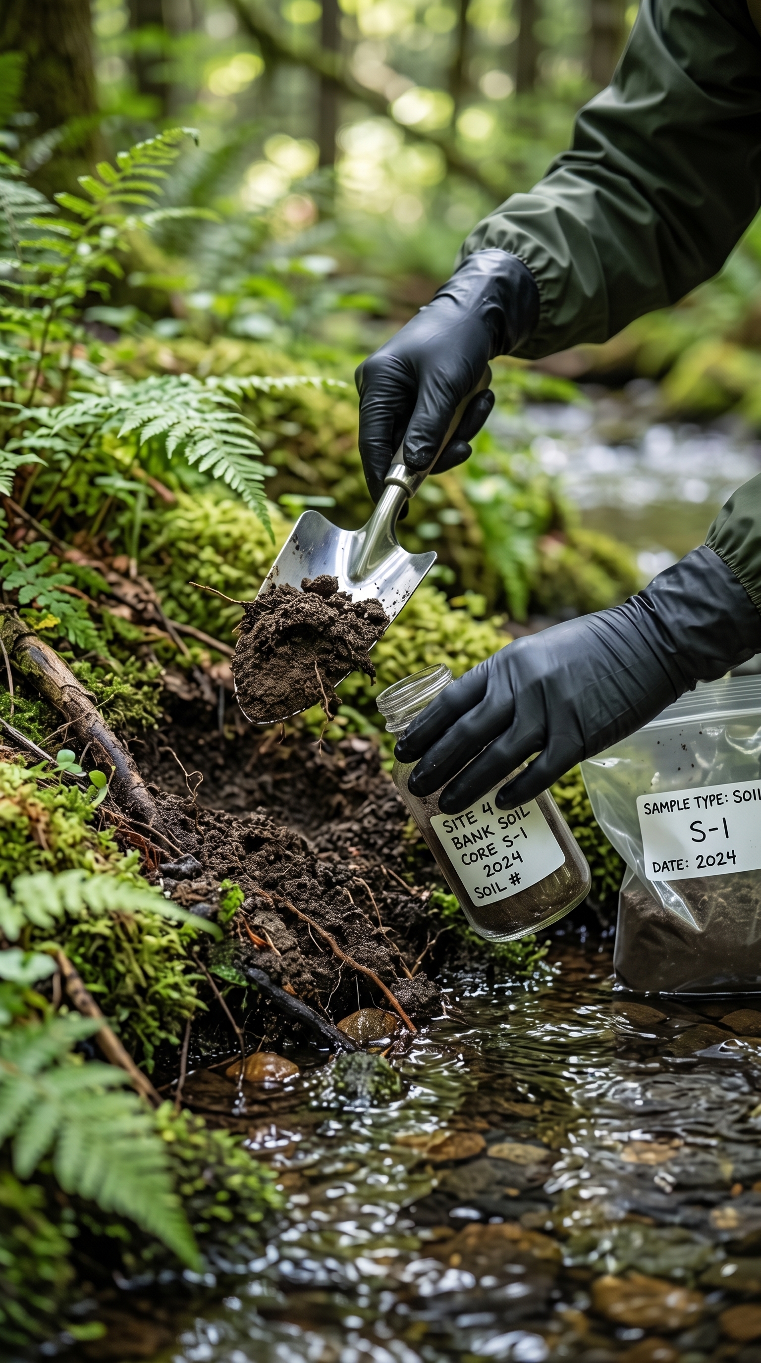
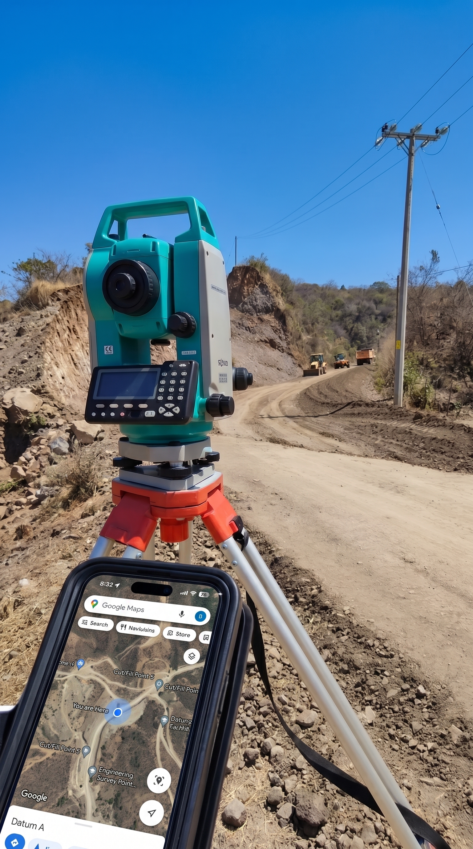
The shift from spreadsheets and GPS files to a live map fundamentally changed how Bowron collects and validates spatial data. Instead of receiving inconsistent formats, field staff draw polygons, add annotations, and log sample points directly on the map. Lease boundaries are clearly defined, which keeps field activity within the correct site extents and reduces the risk of working outside permitted areas.
How Geospatial Visibility Changed Field Execution
One concrete example illustrated the impact clearly. On a project with between three hundred and five hundred sample points, Matidor's map view was essential for managing execution at scale. Field technicians could see which points had already been sampled and which remained, eliminating numbering errors and duplicate work. Live data uploads and georeferenced photos gave project managers precise, up to date visibility into site conditions while work was underway.
In another case, a field technician collected a sample at the wrong location. Because the sample point was georeferenced on Matidor's map, the positional error was immediately apparent. The point fell outside the expected boundary and the technician returned to collect from the correct location before the mistake impacted project deliverables.

Budget and Cost Control
Bowron runs budget and cost control through Matidor as a single source of truth. Field personnel enter costs daily, office staff log time, and all entries are consolidated within the platform. With multiple budget scopes running simultaneously, descriptive cost entries by project type give the team the visibility needed to monitor spend as work progresses rather than after the fact.
Field Operations and Mobile Data Capture
Bowron has created scope specific forms for each project type, with required fields that ensure critical information is always captured. Field staff use tablets and phones to add drawings, log sample points, and document site observations in real time, which gives the office immediate access to complete, structured data without chasing it down through email.
A recent last minute sample request illustrates this end to end workflow. When a client requested additional samples at the last minute, an office team member drew the new locations directly in Matidor. Field personnel saw the updated plan immediately, navigated to the correct locations, and plotted the samples on the map using GPS enabled devices, while chain of custody documentation was generated on the spot because sample names were already in the system.

Power BI Integration and Automated Reporting
The direct data link between Matidor and Power BI has become a key part of Bowron's reporting stack. The team uses Matidor data to power weekly client update dashboards and is expanding scope specific reporting workflows that draw from the same source of truth.
Results and Impact
Results and Impact
"Reduced time spent on manual tracking and reporting, less administrative effort, improved accuracy, better informed decisions, and the ability to prioritize work more efficiently. We have been able to take on a higher volume of projects without adding administrative overhead."
Laura Jardin, Intermediate Environmental Scientist, Bowron Environmental Group

Real Time Visibility, Less Admin, Better Decisions
The operational shift was clear and team wide. Field data quality improved, budget visibility became real time, and the ability to validate work spatially unlocked efficiencies that were simply not possible when projects existed only as spreadsheet rows and email threads.
Related Customer Stories

How Peyto replaced spreadsheet based ARO tracking with real time cost visibility and GIS mapping across a growing post acquisition portfolio.
See Case Study →Learn More
How Karve manages remediation budgets within one percent using daily cost tracking and real time consultant coordination.
See Case Study →Learn More