.jpg)

The Weld County data falsification case revealed a critical issue in the oil and gas industry: unreliable data can lead to regulatory violations, financial losses, and damaged public trust. Between 2021 and 2024, over 3,200 data points were falsified at 404 sites, leading to costly resampling and remediation efforts. This incident highlights the need for better tools and processes to ensure accurate reporting.
Key takeaways:
- What happened: Two consulting firms falsified environmental data, including benzene levels and contamination dates, affecting hundreds of sites.
- Why it matters: Accurate data is essential for safety, compliance, and maintaining public trust. Errors can cost millions in fines, downtime, and remediation.
- Solutions: Modern systems like GIS-based field operations software can prevent manipulation with real-time data capture, automated validation, and audit trails.
The oil and gas sector must prioritize advanced tools and stricter oversight to avoid similar incidents. Investing in reliable data systems isn’t just about compliance – it’s about safeguarding operations and reputation.
Common Problems with Data Accuracy in Oil & Gas
The oil and gas industry handles an overwhelming amount of data every day. Yet, according to McKinsey research, fewer than 1% of 30,000 data points actually make it to decision-makers in the sector. This underutilization highlights major flaws in data handling and accuracy, leaving room for manipulation and errors. These issues often stem from weaknesses in how data is collected, managed, and used.
Where Data Collection Goes Wrong
One of the biggest culprits behind inaccurate data is manual entry errors. The Weld County case is a prime example, where technicians manually recorded measurements from remote sites, leading to distorted datasets that could be easily manipulated.
Another issue is the prevalence of data silos. Information often gets stuck within specific departments or with individual employees, making it hard for companies to share insights across operations. For instance, field engineers might have critical operational knowledge, but data analysts are left working with incomplete or isolated datasets. This lack of integration creates blind spots where inaccuracies can slip through unnoticed.
What happens in organizational structure, those three groups are separated. You can’t really make integrated field decisions unless you have all pieces of the information.
Riccardo Bertocco, Partner at Bain & Co.
Adding to the problem is the absence of real-time validation. Traditional data collection methods often involve delays between gathering information and analyzing it. During these delays, conditions in the field can change, equipment might fail, or environmental factors could shift – none of which get accurately captured in the data.
The sheer complexity of oil and gas operations also opens the door to errors. Companies deal with massive volumes of data, struggle to integrate different systems, and face inconsistent data quality across sources. When systems don’t communicate effectively, it becomes harder to detect both accidental mistakes and intentional data manipulation. These inefficiencies are further compounded by the industry’s strict regulatory requirements.
US Regulatory Compliance Requirements
The oil and gas industry must meet strict data accuracy standards enforced by multiple federal agencies. The ever-evolving regulations add to the challenges of managing operations effectively. A Deloitte report found that only half of energy companies use integrated tools or systems to track their compliance controls.

Cybersecurity has added another layer of complexity. The Transportation Security Administration now requires critical pipeline operators to implement cybersecurity measures. In Q1 2024, the global oil and gas sector saw an 87% spike in company filings mentioning cybersecurity, while 67% of energy companies were targeted by ransomware attacks last year. Exploited vulnerabilities are a major factor in these attacks, affecting 62% of computer systems and compromising 79% of backups compared to other industries.
What Happens When Data Gets Falsified
The fallout from data falsification can be devastating, stretching far beyond regulatory fines. For example, in the Weld County case, falsified environmental data forced authorities to re-evaluate 217 previously closed sites.
The financial consequences can also be severe. Take the 2021 Amplify Energy offshore spill, which resulted in a $50 million settlement and a $5 million penalty under The Clean Water Act. Similarly, the Colonial Pipeline ransomware attack cost the company $4.4 million in ransom payments.
Reputation damage is another significant risk. Once trust is broken, rebuilding it can take years. Companies may face increased oversight, mandatory third-party audits, and additional reporting requirements, all of which add to operational burdens. Bain & Company estimates that better data analysis could increase oil and gas production by 6 to 8 percent. However, this potential remains untapped as long as data accuracy issues persist. Tackling these challenges will require advanced, real-time solutions, which will be explored in the next sections.
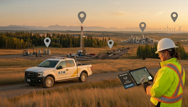
How GIS-Based Field Operations Software Improves Transparency
The data accuracy issues seen in the Weld County case didn’t have to happen. Modern GIS-based field operations software offers solutions that tackle the root causes of data manipulation and inaccuracies head-on. These systems create real-time data ecosystems, ensuring information flows seamlessly between field teams and office staff. This approach eliminates the gaps that often lead to errors and makes it far harder for data to be tampered with. Essentially, these tools connect field operations directly to executive oversight, fostering a more transparent workflow.
Key Features That Enhance Transparency
Real-time data capture is at the heart of transparent operations. GIS-based systems automatically collect GPS data, removing the risk of manual entry errors.
When paired with IoT sensors, these systems enable continuous monitoring of pipeline conditions like pressure, temperature, and flow rates. This ensures a tamper-proof stream of data, making it nearly impossible to alter or falsify information.
Comprehensive audit trails further strengthen accountability. Every action – whether it’s a data entry, modification, or access – is logged with timestamps and user details. This makes unauthorized changes easy to spot and deter.
Mobile compatibility allows field workers to input data directly on-site, cutting out delays and reducing opportunities for data manipulation. By replacing outdated paper-based systems, as seen in the Weld County case, these tools enable faster and more accurate data collection.
Map visualization turns complex datasets into user-friendly visuals. Instead of sifting through spreadsheets or text-heavy reports, stakeholders can view data on geographic maps. This makes inconsistencies or anomalies easier to spot, ensuring compliance with regulatory standards.The financial benefits are also worth noting. One oil and gas company reported $2 million in first-year savings after adopting field data collection apps. These savings came from fewer errors, quicker data processing, and overall operational improvements.
Addressing Weld County’s Issues
GIS-based solutions directly address the vulnerabilities exposed in the Weld County case. Where manual data entry allowed for manipulation, automated systems eliminate the need for human input during initial data collection.
The problem of data silos is resolved through integrated platforms that ensure all teams – from field engineers to management – work with the same real-time data. This unified access eliminates the disconnects that previously allowed inaccuracies to go unnoticed.
Real-time validation replaces the slow verification processes that created opportunities for tampering. Advanced software analyzes data as it’s collected, flagging anything outside expected parameters and alerting supervisors immediately. This prevents falsified data from entering official records.
GIS systems also simplify compliance reporting. Instead of manually compiling reports from scattered sources, companies can generate accurate, visual documentation directly from their integrated systems. These tools also address geographic challenges, automatically mapping underground assets with GPS data. This ensures precise tracking of locations, even in areas where surface conditions have changed. Such precision is especially critical for environmental monitoring, where exact location data determines the scope of contamination.
Case Study: Using Technology for Transparent Field Operations
Weld County’s challenges highlight how the right technology can bring clarity and integrity to field operations. Matidor‘s platform serves as a prime example of how modern tools can ensure accountability at every stage of data collection and management.
Real-Time Project Tracking and Data Validation
Matidor’s real-time tracking capabilities tackle one of the biggest pain points: human error in data entry. By automatically capturing GPS coordinates and timestamps, the platform creates a reliable, unchangeable record of field activities – pinpointing exactly where and when work happens. This automation drastically reduces errors and makes tampering with data virtually impossible.
The platform also integrates IoT sensors to monitor key metrics like pressure, temperature, and flow rates. If something seems off – like a sudden spike in pressure – these sensors flag it immediately for review. Plus, automated validation compares incoming data against historical trends and regulatory benchmarks in real time. If a field worker’s input doesn’t match sensor readings or falls outside expected parameters, additional checks are triggered before the data is accepted. This layered approach helps prevent the kind of data manipulation that plagued Weld County.
Together, these features lay the groundwork for better teamwork and well-documented workflows.
Team Collaboration and Workflow Documentation
Matidor strengthens collaboration by addressing communication breakdowns, a major issue in Weld County. Its real-time multi-user editing ensures that field teams, supervisors, and compliance officers work from the same live dataset. This eliminates data silos and ensures consistency across departments.
The platform also allows location-based comments and real-time messaging tied to specific assets or geographic areas. For instance, if a technician spots an issue, they can immediately notify supervisors and regulatory teams, creating a clear and traceable communication trail for faster resolution.
Audit trails are another game-changer. Every action – whether it’s data access, edits, or approvals – is documented with user IDs and timestamps. Unlike Weld County’s outdated paper-based systems, these digital workflows create a permanent, transparent record. David Woolley, GIS Analyst at the City of Fountain, captures the impact perfectly:
Data cleanup is important because we’re trying to keep the lights on. We’ve got crews out there at two in the morning, and if we’re providing them with inaccurate information, the work takes longer, plus it’s more expensive and difficult.
Even in remote areas with limited connectivity, a platform like Matidor keeps things running smoothly. Field teams can collect data offline and sync it later, ensuring their records stay accurate and up-to-date.
Meeting Regulatory Standards
Matidor doesn’t just simplify operations – it also helps companies stay on top of regulatory requirements. Its traceable and verifiable data meets US regulatory standards, including the documentation needed for 49 CFR 192 and 195 compliance. The platform automatically compiles detailed records and maps for every asset.
By automating report generation, Matidor eliminates the need for manual processes that can lead to errors or manipulation. Its built-in risk analysis tools help operators identify potential compliance issues early, assigning risk scores for High Consequence Areas (HCAs) as required by PHMSA regulations.
Additionally, GIS-based modeling enhances regulatory efforts by predicting spill spread patterns and identifying areas that could be impacted. This allows emergency response teams to plan effectively, reducing risks and protecting public safety.
That confidence is exactly what Weld County lacked. Without reliable data, regulatory vulnerabilities left the door open to allegations of falsification – a problem that platforms like Matidor are designed to prevent.
Old Methods vs. GIS-Based Solutions
Traditional operations often face issues like accountability gaps and slow reporting processes. GIS-based solutions tackle these challenges head-on, offering a more streamlined and efficient approach. This contrast is particularly evident when examining the operational hurdles faced in Weld County.
Weld County’s struggles highlight the limitations of outdated systems and underscore the need for advanced, technology-driven solutions.
Comparison Table: Old vs. New Methods

Key Benefits of GIS-Based Solutions
The table above clearly shows the operational improvements GIS technology can deliver. Beyond the numbers, the real-world impact of these solutions is transformative.
Cost savings are a major driver of adoption. For instance, optimized routing powered by GIS can cut pipeline routing costs by up to 15%, while also creating more environmentally conscious routes. These aren’t just theoretical benefits – companies already using GIS systems report significant operational gains.
Fuel savings offer another compelling advantage. Optimized routing has enabled some companies to save up to 38 million liters of fuel by minimizing idling and improving route efficiency. For industries like oil and gas, where field crews often operate across vast areas, these savings translate into substantial cost reductions.
The market’s rapid growth reflects the confidence in GIS technology. The GIS market, particularly in sectors like oil and gas, is projected to grow at a compound annual growth rate of 12.5%, reaching $26.27 billion by 2030. This expansion signals that companies are seeing tangible returns on their investments in GIS systems.
Operational efficiency is another game-changer. GIS tools not only reduce costs but also enhance decision-making, improve team collaboration, and strengthen safety measures. Unlike the fragmented methods that contributed to Weld County’s issues, these integrated systems enable better resource management and proactive risk mitigation.
Best Practices for Preventing Data Falsification
The allegations in Weld County highlight how data integrity issues can tarnish an entire industry’s reputation. For oil and gas companies, the solution lies in putting systems in place to prevent falsification before it happens. The secret? Layered validation protocols that make tampering nearly impossible while keeping operations running smoothly.
Protocols for Data Authenticity
Data verification and validation are non-negotiable. According to the US EPA, data verification ensures completeness, correctness, and compliance with methods, procedures, or contractual requirements. Data validation takes it further by assessing the overall analytical quality of the dataset.
To boost data authenticity, companies should adopt a four-step validation process:
- Confirm analytical methods and reporting levels
- Review quality control measures
- Inspect lab procedures
- Evaluate comprehensive Data Validation Packages
Metadata can be a game-changer. Timestamps, GPS coordinates, and user details create a digital fingerprint for each data point, making falsification extremely hard to pull off unnoticed.
Adding independent third-party analysis introduces another layer of security. Environmental Database Reviews, for instance, use publicly available data from federal, state, and local agencies to spot inconsistencies that internal reviews might miss. These reviews are a crucial first step in environmental due diligence and help catch issues early.
These measures form the foundation for ongoing oversight and continuous improvement in maintaining data integrity.
Continuous Monitoring and Improvement
Real-time monitoring flips the script on data validation. By integrating GIS-based software with SCADA and IoT devices, companies can continuously monitor assets and flag anomalies as they happen.
Automated systems take it a step further by collecting, validating, and publishing data in real time. They can instantly identify unusual patterns, missing data, or out-of-range values, triggering immediate human review. This proactive approach directly tackles vulnerabilities like those seen in Weld County, stopping problems before they escalate.
Routine audits are essential for maintaining high standards. Companies should schedule:
- Monthly internal audits of data collection processes
- Quarterly reviews of validation protocols
- Annual comprehensive assessments of data management systems
These audits should include random sampling of field data, verification of equipment calibration, and interviews with field personnel to ensure procedures are followed correctly.
Predictive analytics powered by AI offers yet another layer of defense. These systems analyze historical data to learn normal patterns, flagging deviations that could signal tampering or equipment malfunctions. By catching potential issues early, companies can avoid major compliance headaches.
Feedback loops refine the process. Whenever validation uncovers errors or inconsistencies, companies should trace the root cause and adjust protocols to prevent a repeat. This might mean updating training programs, upgrading equipment, or tweaking processes.
Meeting US Regulatory Standards
Staying compliant with US regulations requires consistent validation practices. Proper documentation is critical. This means maintaining chain-of-custody records for all samples, using standardized forms for data collection, and ensuring timestamps reflect local time zones clearly. Digital signatures and electronic approval workflows create audit trails that regulators can easily follow.
Quality Assurance Project Plans (QAPPs) are essential. These documents outline data quality goals, sampling procedures, analytical methods, and acceptance criteria. Every field operation should have an approved QAPP that staff consistently follow.
For temperature readings, use Fahrenheit, with all equipment calibrated to NIST standards. Pressure should be recorded in pounds per square inch (PSI), and flow rates should be measured in standard cubic feet per minute (SCFM) or barrels per day (BPD), depending on the application.
Finally, training programs should stress the importance of accurate data collection and the severe consequences of falsification. Employees need to understand not just how to collect data but also why precision matters – for environmental protection, public safety, and regulatory compliance.
Conclusion: A Clear Path Forward for Oil & Gas
What We Learned from Weld County
The Weld County scandal brought to light the falsification of 3,275 data points across 683 lab reports from 404 locations. Environmental consultants were found to have altered chemical levels, dates, and even signatures, leading to contaminated sites being inaccurately deemed safe. This manipulation, which occurred between 2021 and 2024, impacted three major companies responsible for nearly 90% of Colorado’s oil production in 2023. Julie Murphy, Director of the ECMC, summed up the gravity of the situation:
This remains a disheartening and heavy subject and as you will hear, our investigation has revealed further issues than were initially reported to us.
This case serves as a stark reminder that operators are ultimately accountable for the accuracy of their data, even when outsourcing to third-party contractors. It highlights the pressing need for more dependable and advanced solutions.
How Technology Drives Transparency
GIS-based field operations software offers a practical solution to the issues uncovered in Weld County. These platforms combine real-time project tracking, automated data checks, and detailed audit trails, making it harder for data to be tampered with. When paired with IoT sensors, they enable constant monitoring, flagging irregularities as they happen. The adoption of GIS technology in the oil and gas sector is projected to grow at a 12.5% annual rate, reaching a market value of $26.27 billion by 2030. Yvette Oldacre, ExxonMobil‘s Global Low Carbon Solutions manager, emphasized the growing importance of geospatial tools:
There comes a point where you have to move from seeing the data to seeing the place – understanding where the value lies. Geospatial is critical and a growing piece of the puzzle.
By leveraging these tools, the industry can take meaningful steps toward greater accountability and reform.
Next Steps for Industry Adoption
The industry now has an opportunity to shift from reactive responses to proactive measures. To achieve this, oil and gas companies should prioritize implementing GIS-based solutions that integrate smoothly with their current systems. These platforms should offer features like offline functionality, mobile access, and seamless compatibility to streamline operations and improve data accuracy. With development costs ranging from $8,000 to $25,000, these systems are a manageable investment for companies of all sizes.
Equally important is engaging stakeholders to ensure transparency at every level. Occidental Petroleum has already expressed its commitment to accuracy:
We are committed to ensuring that everything submitted on behalf of Oxy is accurate.
FAQs
How does GIS-based field operations software help prevent data falsification in the oil and gas industry?
GIS-based field operations software plays a key role in safeguarding data integrity by offering real-time tracking, mapping, and validation. These capabilities provide a clear and accurate view of location-based data, making it much simpler to spot irregularities or unauthorized edits. The result? Greater transparency and accountability across operations.
By streamlining workflows and consolidating data into a single, secure system, this software ensures field data stays consistent, traceable, and resistant to tampering. It minimizes the chances of data manipulation while helping businesses meet regulatory standards. Features like automated alerts and comprehensive audit trails add another layer of security, reinforcing trust and operational transparency.
What are the main advantages of using real-time data validation and monitoring in oil and gas operations?
Real-time data validation and monitoring systems bring a host of advantages to oil and gas operations. One of the standout benefits is the early detection of potential problems, which can help avoid expensive downtime and interruptions in operations. These systems deliver precise, current information that sharpens decision-making and allows teams to react swiftly to changes on the ground.
Another major advantage is how they support regulatory compliance by ensuring data is both accurate and transparent, which helps minimize the risk of fines or penalties. They also enhance operational efficiency by simplifying workflows and making better use of resources. In short, these technologies are essential for maintaining safety, cutting costs, and upholding accountability throughout the industry.
How can modern technology help oil and gas companies meet US regulatory requirements?
How Modern Technology Supports Compliance in Oil and Gas
Modern technology is reshaping how oil and gas companies meet US regulatory requirements, particularly by improving data accuracy and reliability. With advanced tools, businesses can leverage real-time monitoring, centralized tracking systems, and automated reporting to simplify adherence to safety, environmental, and operational standards.
These advancements also strengthen data transparency and integrity. Detailed validation processes and audit-ready documentation reduce errors and ensure accountability. This not only helps companies stay ahead of compliance demands but also enhances operational efficiency and reinforces trust with regulators and stakeholders alike.
.webp)
.webp)
.webp)
.webp)
%20(2).webp)
.webp)
.webp)


.webp)

.webp)

.jpg)

%20(1).webp)


.jpg)
.jpg)
.jpg)


.jpg)