Managing vegetation is challenging without the right tools. Geographic Information Systems (GIS) and geospatial mapping are transforming how organizations handle vegetation control, making the process more precise, efficient, and informed.
Here’s what GIS offers:
- Data Integration: Combines satellite imagery, terrain details, and vegetation data into one platform.
- Real-Time Insights: Pinpoints high-priority areas, predicts growth trends, and optimizes resource use.
- Compliance Made Simple: Automates record-keeping and reporting to meet regulations.
- Cost Savings: Reduces travel, fuel costs, and waste by optimizing routes and material use.
GIS eliminates guesswork, minimizes manual errors, and ensures vegetation management is smarter, faster, and compliant. Let’s explore how it works.
Key GIS Features for Vegetation Control
GIS technology has become a game-changer for vegetation management, offering tools that streamline how data is collected, analyzed, and acted upon. These features work together to replace outdated, manual processes with a seamless, data-driven workflow.
Data Collection and Integration
Modern GIS systems bring together data from various sources into a single, unified database. For instance, GPS devices mounted on field vehicles record exact coordinates during inspections, creating detailed spatial records. Meanwhile, satellite imagery and aerial photography supply high-resolution updates on vegetation conditions across large service areas.
Remote sensing adds another layer of precision. By analyzing vegetation density, health, and growth patterns through spectral data, it can pinpoint stressed vegetation, invasive species, or rapidly growing areas. These updates occur regularly, ensuring data stays current.
Field crews equipped with GIS-enabled mobile devices can log treatment details – such as application rates, equipment used, and environmental conditions – straight into the central database. This eliminates the errors common with paper-based systems and ensures supervisors and planners always have the latest information at their fingertips.
For example, utility companies can combine transmission line data with vegetation monitoring information to quickly identify areas where overgrown trees could threaten infrastructure.
Once this high-quality, integrated data is in place, GIS tools can transform it into actionable insights.
Spatial Analysis and Visualization
GIS excels at turning raw data into insights through advanced spatial analysis. For instance, buffer analysis can automatically flag vegetation near critical infrastructure, ensuring these areas are prioritized for action.
Slope analysis is another powerful tool, helping teams predict where vegetation management might be more difficult. In steep or rugged terrain, specialized equipment or safety measures may be needed, and GIS can highlight these areas during the planning phase.
Visualization tools simplify complex data. Heat maps, for example, can highlight regions with intense vegetation growth, making it easy to spot areas that need immediate attention. Time-series animations reveal seasonal growth patterns, helping managers anticipate peak periods and plan treatments accordingly.
Layered mapping allows users to focus on specific concerns, such as sensitive habitats, water sources, or infrastructure proximity. Custom symbols make it easy to distinguish between vegetation types, treatment methods, and risk levels. Interactive dashboards take it a step further, letting managers drill down from a broad overview to specific sites. With features like pop-up windows, they can access detailed information such as treatment history, upcoming maintenance plans, and compliance records.
Real-Time Monitoring and Historical Comparison
GIS doesn’t stop at analysis – it also enhances real-time decision-making and long-term planning. Real-time data synchronization ensures everyone on the team works with the latest information. For example, when field crews complete treatments using mobile GIS apps, updates instantly appear on supervisors’ dashboards, preventing duplicate work and allowing for dynamic resource allocation.
Automated alerts can notify managers when vegetation growth exceeds certain thresholds or when maintenance deadlines are approaching. Over time, historical comparison tools help identify trends – like areas that consistently require more intensive management. This insight allows organizations to refine their maintenance schedules and budget plans.
GIS also helps assess the effectiveness of different treatments. By comparing vegetation responses over time, teams can identify the most successful methods. Before-and-after imagery provides visual proof of results, useful for both internal reviews and regulatory reporting. Plus, trend analysis helps predict future needs, enabling proactive scheduling and reducing the likelihood of last-minute emergencies.
How to Use GIS in Vegetation Management
GIS technology transforms vegetation management into a proactive, data-driven process. By leveraging spatial analysis, field teams can anticipate potential issues, allocate resources more effectively, and maintain detailed records to meet regulatory requirements.
Identifying High-Risk Areas
One of the key capabilities of GIS is its ability to identify areas that pose risks to critical infrastructure. Buffer zone analysis is a common approach, where the system creates protective zones around assets like power lines or pipelines. These buffer distances are set based on the importance of the asset and regulatory standards. If vegetation encroaches on these zones, the system flags the area for attention.
The Normalized Difference Vegetation Index (NDVI) is another powerful tool. Using satellite imagery, NDVI monitors vegetation health, helping teams spot rapid growth that could signal invasive species or unusually dense vegetation requiring intervention.
GIS also supports slope analysis, which identifies terrain challenges before crews head out. Steep or uneven areas may need specialized equipment or additional safety precautions. Similarly, proximity analysis highlights sensitive areas, such as wetlands or habitats of endangered species, ensuring proper care is taken.
By integrating weather data, GIS enhances risk assessment even further. Areas with weather conditions that promote rapid vegetation growth can be prioritized for inspections, reducing the chance of small issues turning into major problems.
These insights allow teams to plan their schedules and allocate resources with precision, as explained below.
Scheduling and Resource Allocation
GIS platforms equipped with growth prediction models help forecast when and where vegetation management is required. By analyzing historical growth trends, weather patterns, and local vegetation characteristics, these tools aid in planning treatments and managing budgets more effectively.
Route optimization is another valuable feature. It minimizes travel time by considering crew locations, equipment needs, and site accessibility. This streamlining of daily work schedules reduces operational costs and increases efficiency.
GIS also ensures the right resources are assigned to the right tasks. By factoring in terrain, vegetation type, and environmental considerations, the system matches crews and equipment to specific job requirements.
Seasonal planning benefits significantly from GIS data. By identifying the best treatment windows based on vegetation cycles, weather conditions, and regulatory requirements, managers can schedule tasks for maximum impact.
With optimized schedules and resource allocation, field teams can work more efficiently while maintaining clear communication and accountability.
Field Team Coordination and Post-Treatment Verification
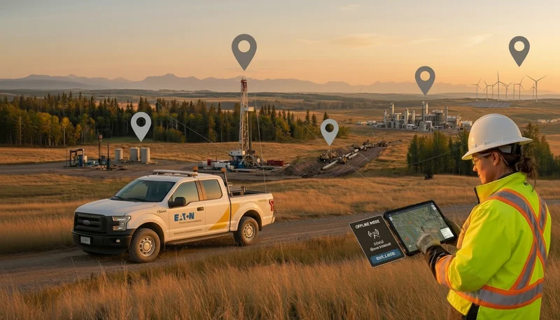
GIS plays a crucial role in field team coordination and treatment verification. Mobile GIS apps connect field crews to a central database in real time, allowing them to document work with geotagged, time-stamped entries – even in offline conditions. Once connectivity is restored, the data syncs seamlessly, ensuring uninterrupted operations.
Integrated work order management simplifies field operations by providing crews with detailed maps, routes, and instructions. As tasks progress, team members can update statuses, report challenges, and request additional resources, while supervisors monitor progress and adjust plans as needed.
Post-treatment verification is made easier with automated scheduling of inspections. Field inspectors can use mobile devices to confirm treatment quality, measure clearance distances, and identify areas requiring further action.
Interactive dashboards give managers a real-time view of project progress, budget usage, and upcoming deadlines. This level of transparency supports informed decision-making and ensures projects stay on track.
Meeting Regulatory Compliance and Environmental Requirements
GIS technology not only improves efficiency in vegetation management but also simplifies compliance with a maze of federal, state, and local regulations. These rules can be complex, but digital tools like GIS make navigating them more manageable. Let’s explore how GIS enhances both regulatory compliance and environmental responsibility.
Auditable Records and Map-Based Reporting
GIS systems excel at creating detailed digital records of vegetation management activities. With automated reporting features, they compile essential data like coordinates, timestamps, and descriptions of completed work. These records are then used to produce interactive maps that visually summarize treated areas and highlight nearby sensitive locations. This level of detail ensures organizations are prepared for audits and can easily demonstrate compliance with regulations.
Reducing Environmental Impact
GIS goes beyond compliance by helping organizations minimize their environmental footprint. By combining spatial data with environmental information, it becomes easier to pinpoint areas that require special attention. For instance, overlaying treatment plans on maps of habitats or water bodies allows for the creation of protective buffer zones. These zones help prevent chemical drift, limit soil erosion, and protect native vegetation and ecosystems.
Real-time environmental data, such as weather patterns and soil moisture levels, can also be integrated into GIS systems. This data helps fine-tune treatment schedules, ensuring that actions are taken under the most favorable conditions to reduce unintended impacts. Through this precise and informed approach, GIS not only aids in meeting regulatory requirements but also promotes sustainable vegetation management practices.
Reducing Costs and Resources with GIS
GIS is more than just a tool for precision and real-time monitoring – it’s a game-changer for cutting costs. By shifting vegetation management from a labor-heavy process to a smarter, more efficient system, GIS helps organizations save money in multiple ways. From trimming fuel expenses to smarter material use, the financial advantages are clear.
Cutting Down Travel and Fuel Costs
One of the quickest wins with GIS is route optimization. In traditional vegetation management, crews often spend a lot of time and fuel traveling between scattered work sites. GIS changes the game by analyzing spatial data to create efficient work clusters.
With GIS, treatment locations are grouped intelligently, shortening travel distances and reducing fuel consumption. Even better, real-time updates allow for quick route recalculations when conditions shift, keeping crews productive and minimizing unnecessary trips.
Smarter Use of Materials and Equipment
GIS doesn’t just save on travel – it makes material and equipment use far more efficient. By combining vegetation maps with terrain data, managers can calculate exactly how much herbicide is needed, cutting down on waste and guesswork.
When it comes to equipment, GIS ensures that resources like heavy machinery or specialized spraying rigs are deployed strategically. Terrain and vegetation patterns guide where and when equipment is needed, so only the essentials are transported to each site. This not only streamlines individual projects but also helps maintain better control over inventory and resource allocation.
GIS also integrates financial tracking tools, allowing real-time monitoring of savings. By combining spatial analysis with budget oversight, organizations get a complete, data-driven strategy for managing resources. It’s a perfect example of how GIS doesn’t just improve operational precision – it transforms how resources are managed across the board
Conclusion: Improving Vegetation Control with GIS
GIS technology has reshaped vegetation control, turning what was once a reactive and labor-intensive process into a data-driven, efficient management system. From planning to compliance, GIS enhances every stage of vegetation management.
With GIS, operations become more efficient by pinpointing high-risk areas, fine-tuning treatment schedules, and coordinating resources effectively. These improvements lead to faster response times, less equipment downtime, and smarter use of personnel across various locations. As a result, organizations can manage vegetation more effectively while addressing broader environmental and regulatory challenges.
On the environmental front, GIS helps reduce ecological disruption. By ensuring treatments are applied only where needed, it prevents overuse and safeguards sensitive habitats. Real-time monitoring also enables quick adjustments to align with changing environmental conditions, ensuring precision and care.
When it comes to regulatory compliance, GIS simplifies the process by automating record-keeping and generating detailed, auditable reports. This reduces the administrative workload and ensures organizations stay on top of requirements.
Finally, the financial benefits of GIS are hard to ignore. Smarter resource management – like optimizing routes to cut fuel costs, using precise material calculations to eliminate waste, and deploying equipment strategically – results in significant savings. Over time, these efficiencies add up, making GIS not just a tool for better vegetation control, but also a wise investment
FAQs
How does GIS make vegetation management more efficient than traditional methods?
GIS makes vegetation management more efficient by offering real-time data, detailed mapping, and tools for proactive planning. Field teams can quickly assess vegetation conditions, track treatment progress, and manage assets with accuracy. This reduces the need for constant on-site visits and eliminates much of the paperwork.
Unlike older methods, GIS simplifies decision-making, helps allocate resources efficiently, and supports adherence to safety and environmental standards. The result? Lower operational costs and higher productivity, as teams can concentrate on precise, data-informed strategies.
How does using GIS in vegetation control benefit the environment?
Using GIS for vegetation control offers a range of environmental advantages. For starters, it helps safeguard natural habitats by pinpointing and mapping sensitive areas, ensuring field operations avoid causing unnecessary harm. With its ability to guide the precise use of resources like herbicides or water, GIS significantly cuts down on waste, reduces pollution, and helps prevent harmful runoff from affecting nearby ecosystems.
Beyond that, GIS plays a key role in habitat restoration and effective land management. By analyzing vegetation patterns and tracking land use changes over time, it supports healthier ecosystems, encourages biodiversity, and helps maintain environmental standards in vegetation control practices
How does GIS support regulatory compliance in vegetation management?
GIS is a powerful tool for organizations working to meet vegetation management regulations. It provides detailed mapping and real-time monitoring of vegetation around essential infrastructure like utility lines and transmission systems. With this technology, teams can stay ahead of potential issues, ensuring vegetation is managed properly and clearance requirements are consistently met.
Beyond monitoring, GIS makes risk assessment more straightforward and ensures compliance activities are well-documented. This organized approach simplifies regulatory reporting, supports audits, and helps organizations uphold safety and environmental standards more efficiently.
.webp)
.webp)
.webp)
.webp)
%20(2).webp)
.webp)
.webp)


.webp)

.webp)

.jpg)


%20(1).webp)


.jpg)

.jpg)
.jpg)
.jpg)


.jpg)