.jpg)

Environmental Consulting Reporting: A Complete Guide
Accurate reporting is not just a deliverable at the end of a project. For environmental consultants, it is the thread that runs through every site visit, every data point collected, and every regulatory submission filed. When reporting breaks down, projects stall, fines follow, and client trust erodes.
This guide covers what accurate environmental consulting reporting actually requires, how modern tools like GIS and field data software change the equation, and the practices that separate high-performing firms from the rest.
Why Accurate Reporting Matters in Environmental Consulting
Environmental consultants operate in a compliance-first world. Every report they produce can be reviewed by regulators, cited in legal proceedings, or used to justify a remediation strategy that affects public health. Getting it right is not optional.
There are three reasons accurate reporting is foundational to the work:
- Regulatory compliance. Reports must meet the specific format and content requirements of agencies such as environmental regulators and permitting bodies. Errors invite scrutiny and can increase enforcement risk.
- Stakeholder trust. Property owners, developers, municipal governments, and investors rely on environmental reports to make decisions. Inconsistent or unreliable data damages a firm's credibility over time.
- Better project outcomes. Accurate baseline data leads to better remediation plans, more defensible permit applications, and fewer costly surprises mid-project.
Inaccurate Environmental, Health, and Safety (EHS) data can result in regulatory fines, reputational harm, and operational disruptions. Those consequences often far outweigh the cost of investing in better reporting systems.
The Three Pillars of Accurate Environmental Reporting
Building a reliable reporting framework comes down to getting three things right: how data is collected, how quickly it flows, and how consistently it is formatted.
1. Precise Data Collection and Validation
Accurate environmental reporting starts before anyone enters the field. Defining clear objectives and establishing measurable metrics in advance ensures that field teams know exactly what to capture and why.
Validation is the next layer of protection. Standardized protocols, trained staff, and cross‑verification procedures reduce the chance that a transcription error or miscalibrated sensor makes it into a final report.
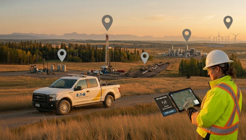
Mobile data collection apps with built‑in GPS have become standard tools for this reason. They capture data directly in digital formats, eliminate handwritten field notes, and geo‑tag every entry automatically. Regular calibration of sensors and data loggers maintains accuracy over the life of a project, while anomaly checks help flag outliers before they skew results.
2. Real-Time Reporting Tools and Technologies
When field data is collected on paper and transcribed manually back at the office, delays and errors are built into the process. Real‑time reporting tools remove both by transmitting data electronically to a central database as soon as it is captured.
The practical benefits include:
- Reports generated from live data, not scattered files
- Compliance documentation that can be partially or fully automated
- Project managers tracking field progress during the day rather than waiting for summaries
- Errors caught at the point of entry instead of during final review
Electronic forms with built‑in checks for completeness and valid ranges help maintain data quality at the source. Barcode scanning and GPS‑guided navigation to sampling locations further reduce the risk of human error in the field.
3. Standardized Reporting Formats
Consistency in format is what makes a report usable across agencies, clients, and project teams. This includes standardized units, consistent date formats, and templates that align with the expectations of regulators and clients.
Clear communication protocols established at the start of a project keep teams aligned and provide a structured way to address challenges. Collaborative report writing, with defined roles and shared quality standards, helps reduce inconsistencies across multi‑person teams.
How GIS Changes Environmental Reporting
Geographic Information Systems (GIS) are now central to how environmental consultants collect, analyze, and present field data. The technology brings two key capabilities that traditional reports cannot replicate: spatial visualization and layered data analysis.
Mapping and Visualizing Field Data
A GIS map communicates more than a table of readings ever can. Contamination plumes, monitoring well locations, compliance boundaries, and remediation progress can all be displayed spatially, making it easier for clients and regulators to understand the scope of a project at a glance.
Consulting firms use field mapping apps to capture and update data boundaries directly from the field, ensuring accuracy from the moment data is collected rather than during post‑processing. GPS‑equipped smartphones bring location accuracy down to just a few meters, which matters when defining the extent of a contaminated area or establishing the boundary of a protected zone.
GIS also allows consultants to layer multiple data types such as soil samples, groundwater readings, vegetation surveys, and infrastructure maps onto a single interactive view. That integrated picture often reveals patterns and relationships that never surface in row‑and‑column reports.
Spatial Analysis for Better Decisions
Spatial analysis is where GIS moves from visualization to insight. It allows consultants to:
- Model flood risk and climate impacts for resilience planning
- Understand heat exposure in urban neighborhoods
- Optimize monitoring well placement and sampling frequency
- Predict contaminant migration under different scenarios
These capabilities lead to more precise risk assessments and smarter decisions about remediation, monitoring, and long‑term management.
GIS in Regulatory Compliance
Compliance workflows benefit directly from GIS. Environmental impact assessments, NEPA reviews, and similar processes require consultants to assess impacts across sensitive resources, demographics, and historic sites, then communicate those findings in a way that is understandable to non‑technical audiences.
GIS‑integrated tools help by:
- Organizing complex datasets into clear map views
- Automating parts of the permitting and documentation process
- Making it easier to respond quickly to regulator questions
Firms that have already built GIS into their standard workflow are better positioned as digital submissions and map‑based documentation become the norm.
Reporting Software Built for Environmental Consulting
GIS handles the spatial side of environmental reporting. Purpose‑built reporting software handles the operational side: project tracking, compliance documentation, and client communication.
Features That Matter
Modern environmental reporting platforms typically include:
- Real‑time project tracking so managers can see field activity, sampling progress, and milestones without waiting for manual updates
- Mobile data sync so field teams can submit data from remote sites and automatically update central records
- Customizable regulatory templates for common report types such as site assessments, groundwater monitoring reports, and air quality studies
- Automated compliance tracking to manage submission deadlines, required forms, and recurring reports
Together, these capabilities shorten the reporting cycle considerably. Some teams report reductions from days of manual work to minutes when they move away from spreadsheets and email‑based processes.
Meeting Environmental Regulations
Reporting software that combines GIS data, structured forms, and workflow automation makes it easier to meet complex regulatory requirements. For example, large utilities and municipal agencies have used GIS‑powered reporting to integrate infrastructure maps, rainfall data, and water quality results for consent decrees and major capital programs.
The same approach scales down to smaller consulting projects, where automated reminders, standardized templates, and centralized data storage reduce both risk and administrative overhead.
Best Practices for Environmental Consulting Firms
Technology is only as effective as the people and processes behind it. The firms that get the most from GIS and reporting tools are the ones that invest in training, integration, and continuous improvement.
Training Field and Office Teams
Hands‑on training, scenario‑based exercises, and peer coaching outperform one‑time classroom sessions. Good training programs for reporting tools typically cover:
- Data collection procedures and field protocols
- How regulatory requirements translate into specific documentation
- The real‑world consequences of inaccurate data
- Practical simulations using the same tools that will be used in the field
Visual, interactive formats tend to boost retention and help teams feel confident using new systems before they step on site.
Integrating Tools Into Existing Workflows
New reporting tools work best when they replace fragmented processes rather than simply adding more steps. That means:
- Embedding GIS and mobile reporting into project kickoffs, not just final reporting
- Standardizing how data flows from field teams to project managers and technical staff
- Retiring redundant spreadsheets and shared drives once the new system is established
Managing the full project lifecycle on a single platform reduces the inefficiencies created by disconnected systems and eliminates translation errors when data moves between tools.
As AI capabilities expand, firms can start with low‑risk applications such as summarizing notes, simplifying technical language for non‑specialist audiences, or flagging potential data anomalies for human review. Clear internal policies around disclosure, accuracy, and privacy will be important as usage grows.
ESG Reporting and Emerging Expectations
The regulatory and stakeholder landscape is evolving quickly. Large companies increasingly publish sustainability and ESG reports, and both investors and customers expect credible environmental data rather than marketing language.
For environmental consulting firms, this creates new opportunities and expectations:
- Clients need support tying site‑level compliance work to broader ESG metrics
- Accurate, auditable data becomes a differentiator in vendor selection
- Reporting practices must be robust enough to withstand external scrutiny
Firms that can connect regulatory compliance, project‑level reporting, and ESG disclosure will be better positioned as expectations continue to rise.
The Business Case for Better Reporting
Accurate reporting is not only a compliance requirement. It has measurable business value.
Companies with strong environmental and sustainability performance tend to see benefits in areas such as operational efficiency, access to capital, and long‑term resilience. Automation reduces the error rates associated with manual spreadsheets, and better visibility into environmental data helps organizations act on issues before they escalate.
For environmental consulting firms, reporting quality directly affects client retention and competitive positioning. A firm that consistently delivers clear, compliant, well‑documented reports builds a reputation that is hard to replicate. A firm that struggles with errors, delays, and format inconsistencies does not.
The tools to close that gap already exist. Firms that invest in better data collection, GIS, and modern reporting platforms are better prepared for a world with stricter regulations, more demanding stakeholders, and higher expectations around environmental performance.
.webp)
.webp)
.webp)
.webp)
%20(2).webp)
.webp)
.webp)


.webp)

.webp)

.jpg)


%20(1).webp)


.jpg)

.jpg)
.jpg)


.jpg)