Environmental monitoring in 2026 is no longer just a checkbox. Tighter federal and provincial regulations, rising ESG disclosure expectations, and growing scrutiny from lenders and investors mean that the quality, traceability, and timeliness of compliance data now has direct implications for how organizations access capital, retain permits, and build community trust.
For environmental managers and consultants across Western Canada, this means the monitoring and reporting workflows that worked three years ago are under pressure. This guide explains what is changing, why it matters for field operations teams, and how a GIS native platform turns compliance data into a strategic advantage rather than an administrative burden.
What is changing in environmental monitoring in 2026
Regulatory expectations are tightening across Canada
Canada's federal and provincial regulators are raising the bar on both the quality and auditability of environmental compliance data. Canada's enhanced methane regulations, finalized in late 2025, are projected to reduce emissions by 72 percent by 2030 from 2012 levels and require energy producers to monitor and document methane management practices with greater rigor. The proposed Oil and Gas Sector Greenhouse Gas Emissions Cap sets the emissions cap at 27 percent below 2026 reported data, making what operators capture and report this year the baseline for future compliance obligations.
At the same time, reporting requirements under the Federal Plastics Registry and other environmental statutes continue to add layers of disclosure for industrial operators, with provincial programs in BC, Alberta, and Ontario each carrying their own deadlines and formats.
ESG disclosures are moving from narrative to audit ready
In 2026, ESG reporting is shifting from a voluntary disclosure exercise to audit ready data infrastructure. Investors, lenders, and regulators are moving away from accepting estimated or narrative disclosures. They now expect evidence based, traceable data that can withstand independent assurance. For environmental teams, this means that monitoring data captured in the field needs to be structured, timestamped, and stored in a system that produces a verifiable chain of custody, not reconstructed from emails and spreadsheets at year end.
Canada's oil and gas sector already leads all Canadian industries in environmental protection spending, with producers and pipeline operators spending 4.3 billion dollars in 2023 alone. That investment is increasingly expected to produce traceable outcomes that satisfy both regulators and ESG frameworks.
Why legacy monitoring workflows create compliance risk
Most environmental monitoring programs were designed for a different era: paper forms in the field, data entry back at the office, PDF reports emailed to clients or regulators. That model creates several compounding risks:
- Data gaps: Information captured on paper or in disconnected apps does not flow reliably into a central record, making it difficult to demonstrate continuous monitoring.
- Inconsistent documentation: Without standardized field forms and workflows, different consultants capture different levels of detail, which creates audit vulnerabilities.
- Delayed reporting: When data has to be rekeyed or reconciled before a report can be produced, teams miss deadlines or rush to compile information under pressure.
- No spatial context: Monitoring results stored as rows in a spreadsheet offer no geographic visibility into which sites are in sensitive zones, which are overdue, or how conditions are evolving across a region.
These problems compound when portfolios grow. A firm managing five sites can paper over workflow gaps. A firm managing 50 cannot.
Four ways GIS native platforms turn monitoring data into an advantage
1. Standardized field workflows that enforce data quality at the source
Compliance data quality is determined in the field, not in the office. When field teams use standardized mobile forms with required fields, automatic GPS tagging, and photo documentation, the data that reaches the central system is already structured and traceable.
Matidor's environmental consulting software provides standardized ESA and monitoring workflows that guide consultants through required documentation steps, enforce chain of custody procedures, and automatically attach GPS coordinates and timestamps to every submission. This means that whether a consultant is completing a Phase I ESA, a groundwater sampling event, or a routine site inspection, they follow the same process and produce the same quality of record.
See also: Environmental Site Inspection and Monitoring for a full overview of Matidor's monitoring workflows.
2. Real time data visibility across the entire monitoring portfolio
Environmental managers cannot wait for weekly status emails to know whether monitoring programs are on track. In 2026, the expectation is that compliance leads and project managers can see the status of every active monitoring site, any overdue submissions, and any anomalies, in real time and without chasing field staff.
Matidor's location intelligence capabilities map every monitoring site geographically, layered with regulatory requirement zones, property boundaries, contamination areas, and jurisdictional boundaries. Teams can filter by assessment phase, compliance status, or client, then drill into any site to see its complete activity history, documents, and recent field submissions. That portfolio wide visibility is the foundation for proactive compliance management rather than reactive firefighting.
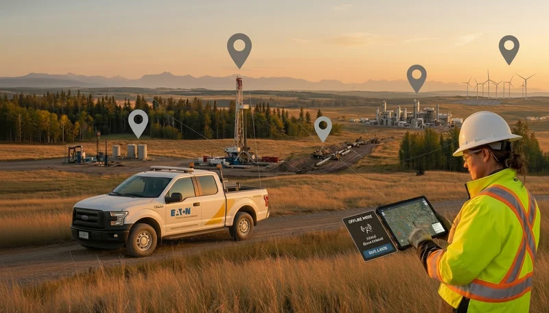
3. Offline first mobile capture for remote monitoring sites
Environmental monitoring rarely happens in well connected locations. Groundwater monitoring wells, tailings ponds, reclamation sites, and remote pipeline corridors all present connectivity challenges that make always-online tools unreliable. When a consultant loses their data because the app did not sync, the monitoring event has to be repeated, or worse, estimated.
Matidor's field operations software is built offline first, meaning field teams download their assignments before leaving the office and capture forms, photos, and notes without requiring a network connection. Data syncs automatically when the device reconnects, with a complete audit trail of who captured what, where, and when. For teams managing monitoring programs in remote areas, this removes a major operational and compliance risk.
4. Audit ready reporting and documentation at portfolio scale
The shift toward audit ready ESG and compliance data means organizations need to produce evidence packs, not just summary reports. That requires a system where raw field data, lab results, photos, and activity logs are all linked to the same project record and can be retrieved, filtered, and exported in formats that satisfy regulators, clients, and assurance reviewers.
Matidor consolidates field documentation, monitoring records, and compliance notes into a single GIS linked system of record. Teams can pull together a complete history of monitoring activity for any site, generate compliance reports with embedded maps and GPS tagged photos, and demonstrate continuous monitoring through timestamped activity logs. For firms reporting under Phase I, II, and III ESA standards, this produces the chain of custody documentation that audits require.
For a deeper look at how to structure monitoring data for regulatory reporting, see Matidor's guide on environmental consulting reporting and accurate reporting in environmental consulting.
Practical steps to modernize your environmental monitoring program
For environmental managers evaluating their current monitoring workflows, consider these four questions:
- Can you produce a complete, time stamped audit trail for any monitoring site in under ten minutes?
- Are field forms and chain of custody procedures consistent across all consultants and contractors, or dependent on individual habits?
- Do you have real time visibility into which sites are overdue for monitoring visits or lab submissions?
- Can you show regulators or ESG reviewers exactly where monitoring data was captured, by whom, and when, directly from your system of record?
If any of these is a gap, it is worth evaluating whether your current tools can scale with 2026 compliance expectations.
Frequently asked questions
What does audit ready environmental monitoring data look like?
Audit ready data is structured, timestamped, GPS tagged, and stored in a governed system where every record has a clear chain of custody. It can be filtered, exported, and presented to regulators or assurance reviewers without manual reconstruction.
How does GIS improve environmental compliance reporting?
GIS adds geographic context to compliance data so teams can see patterns across sites, identify which locations fall within regulated zones, and visualize monitoring coverage at a portfolio level. It also links field data to map based project records, making spatial evidence easy to include in regulatory reports.
What is the difference between site monitoring software and general project management tools?
General project management tools track tasks and milestones. Site monitoring software is purpose built for the regulatory, spatial, and documentation requirements of environmental field work, including standardized forms, GPS tagging, offline mobile capture, chain of custody documentation, and compliance deadline tracking.
How can environmental consulting firms reduce reporting lag?
The fastest way to reduce reporting lag is to eliminate rekeying. When field teams capture data in standardized mobile forms that sync directly into a central system, the data is ready to compile into reports immediately, without transcription or reconciliation steps.
Next steps
If your environmental monitoring program is preparing for tighter 2026 compliance expectations:
- Explore Matidor's environmental services solution page to see how Phase I, II, and III ESA workflows, remediation tracking, and compliance documentation work in one platform.
- Review the environmental site inspection and monitoring page for monitoring specific workflows and capabilities.
- Read the environmental consulting reporting guide for practical advice on structuring data collection and report production.
- Use the Matidor evaluation page to assess platform fit for your monitoring portfolio.
- Request a demo to see real examples of multi site monitoring dashboards, offline field capture, and audit ready documentation in action.
.webp)
.webp)
.webp)
.webp)
%20(2).webp)
.webp)
.webp)


.webp)

.webp)

.jpg)

%20(1).webp)


.jpg)

.jpg)
.jpg)
.jpg)


.jpg)