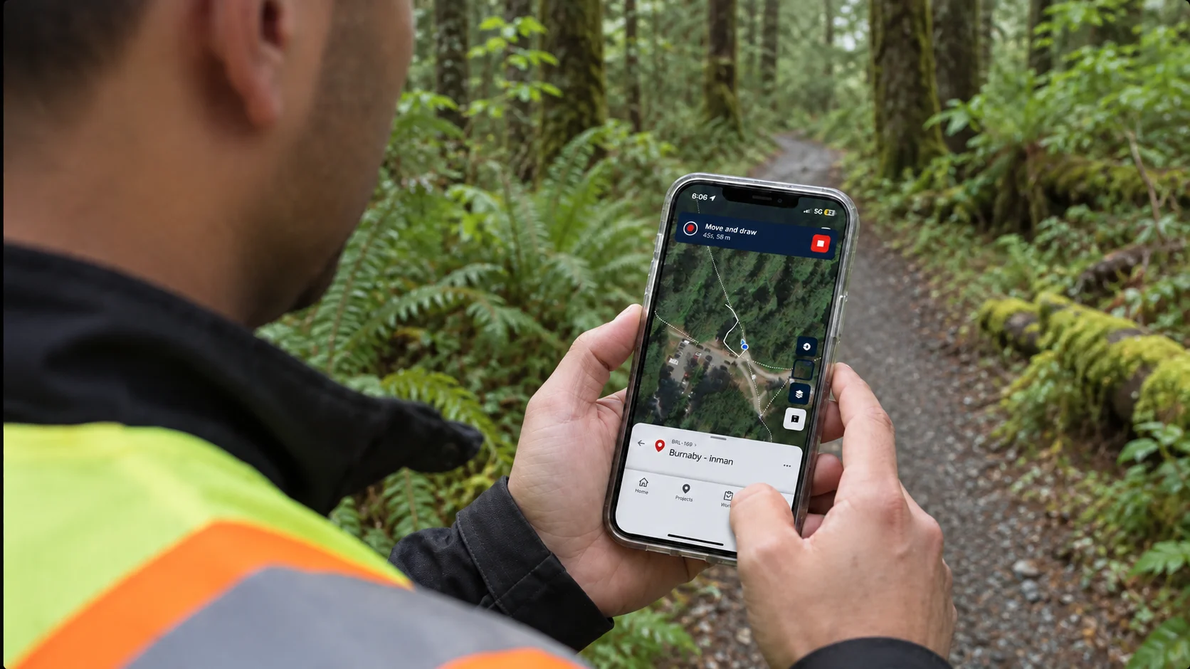

Some field information is easier to capture by moving than by typing.
An access route, inspection path or site perimeter may be obvious while a technician is standing there. Recreating that path later from memory is much harder.
Field notes may explain where the technician went. A photograph may show part of the site. A manually drawn line may provide an estimate. But none of those records captures the actual route as it happened.
Path Recording in Matidor Go offers a more direct approach.
Open a project, select Record a Path and begin walking. Matidor uses the mobile device’s GPS to trace the movement as a drawing on the project map.
The result is a visual field record created while the work is happening.
See how Path Recording turns field movement into a project drawing in Matidor Go.
Why Drawing From Memory Creates Gaps
Many field routes are still documented after the work is complete.
A technician finishes an inspection and sketches the route on a map. Someone in the office interprets field notes and redraws the path. Another team member receives a photograph with an arrow added to it.
Each method depends on someone remembering, interpreting or manually recreating what happened.
That may be enough for a simple site visit. It becomes less reliable when the route must be reviewed by another technician, connected to a project or compared with other map layers.
The problem is not only drawing the line. It is preserving the context behind it.
Where did the technician begin? Which direction did they travel? Did they cover the intended area? Which project, task or inspection does the route belong to?
When movement is captured directly on the project map, fewer details need to be reconstructed later.
Record the Path as You Move
Path Recording turns a technician’s movement into a GPS-based line.
After opening a project in Matidor Go, select Record a Path from the drawing tools. As the technician moves through the site, the line follows the route on the map.
Field teams can use Path Recording to document:
- Inspection routes
- Site access paths
- Perimeter walkthroughs
- Areas covered during fieldwork
- Routes through large or unfamiliar sites
- Visible linear features encountered in the field
When recording is complete, the path becomes part of the project map. The team can label it, adjust its appearance and apply tags so it is easier to identify later.
Instead of leaving an unexplained trail on a standalone map, the recorded path becomes a recognizable part of the project history.
Keep the Path With the Project
A recorded path is more useful when it remains connected to the work around it.
A standalone GPS track may show where someone travelled, but it does not automatically explain why they were there, what they inspected or what they found.
Path Recording keeps the captured route inside the relevant Matidor project. It can be viewed alongside project locations, tasks, photographs, forms, documents and other map layers.
That gives office teams more context when reviewing field activity.
A project manager can see the route in relation to the site. Another technician can understand how the area was approached. A reviewer can compare the recorded path with planned work, environmental constraints or other geographic information.
The path becomes more than a line. It becomes part of the project record.
Continue Recording Offline
The sites that need location-based documentation do not always have reliable cellular coverage.
Remote environmental locations, rights-of-way, industrial properties and rural sites may have weak or unavailable connectivity.
Path Recording can continue while the project is being used offline. A technician can record a route without depending on an active connection and synchronize the project when reliable connectivity becomes available.
That means field teams do not have to choose between completing the work and preserving the route.
The workflow remains consistent whether the technician is near the office or kilometres from reliable service.
Match Accuracy to Purpose
Path Recording is designed for operational field mapping. It does not turn a mobile phone into survey equipment.
The recorded path reflects the positioning available from the device and conditions at the site. Buildings, vegetation, terrain, satellite visibility and device hardware can all affect GPS accuracy.
That makes Path Recording useful for documenting inspection routes, access paths, field coverage and visible site features.
It should not be used to establish a legal boundary or replace professional surveying when a decision requires survey-grade positioning.
The important question is not whether every recorded path is perfectly accurate. It is whether the collection method is appropriate for how the information will be used.
For more on this distinction, read When Approximate GPS Data Becomes a Legal Problem.
Stop Recreating the Field
Field teams already know where they walked.
The challenge is carrying that knowledge into the project record without adding another round of sketches, explanations and manual map updates.
Path Recording captures the route while the technician moves, even when the project is offline. Once saved, the path can be labelled, styled and reviewed alongside the rest of the project information.
No redrawing the route from memory.
No separate tracking app.
No guessing what an arrow added to a map was meant to show.
Just record the path and keep it connected to the work.
Watch the video above to see Path Recording in action.
Book a demo to explore Matidor with your team, or start a free 14-day trial and record a path on your own project.
.webp)
.webp)
.webp)
.webp)
.webp)
.webp)
.webp)
.webp)
.webp)
.webp)
.webp)
.webp)
.webp)
%20(2).webp)
.webp)
.webp)
.webp)

















.webp)

.webp)

.jpg)


%20(1).webp)




.jpg)

.jpg)
.jpg)
.jpg)

.jpg)